Exeter night lights from space
Night Light of Exeter (England) from space (United Kingdom) Src. Average luminocity for 10x10km area is 34.4626% and for 50x50km: 3.796%.
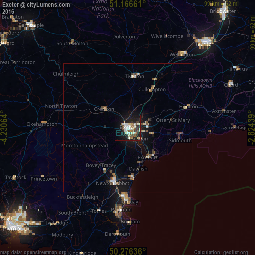
Analysis of Exeter night lights 2016
Square area 10x10 km:
 5.08%
5.08%90-99
9.63%80-89
4.55%70-79
2.14%60-69
2.67%50-59
4.14%40-49
4.14%30-39
4.95%20-29
7.35%10-19
30.61%0-9
24.73%Square area 50x50 km:
0.33%90-99
0.7%80-89
0.42%70-79
0.22%60-69
0.41%50-59
0.7%40-49
0.58%30-39
0.54%20-29
0.62%10-19
3.49%0-9
91.98%Clear (daylight) street map image can be seen on geolist.org.
Map coordinates:
51° 9' 59.8" North, 4° 13' 50.3" West
50° 43' 25" North, 3° 31' 39" West
50° 16' 34.9" North, 2° 49' 27.8" West
Some cities around Exeter sort by population:
• Exmouth
14.8 km =9.2 mi,  143°
143°
• Heavitree
2.2 km =1.4 mi,  99°
99°
• Teignmouth
19.7 km =12.2 mi,  173°
173°
• Kingsteignton
19.7 km =12.2 mi,  191°
191°
• Dawlish
16.4 km =10.2 mi,  164°
164°
• Crediton
10.9 km =6.8 mi,  307°
307°
• Cullompton
17.4 km =10.8 mi,  32°
32°
• Budleigh Salterton
17.9 km =11.1 mi,  125°
125°
2649808 (p: 117,763)
Sources (retrieved 2019-11-25):
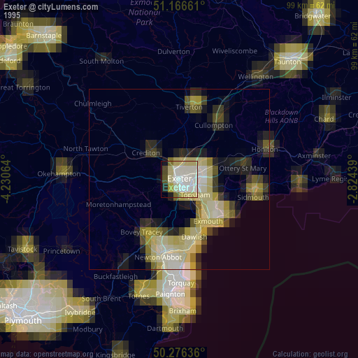
» NASA, Earths city lights 1995
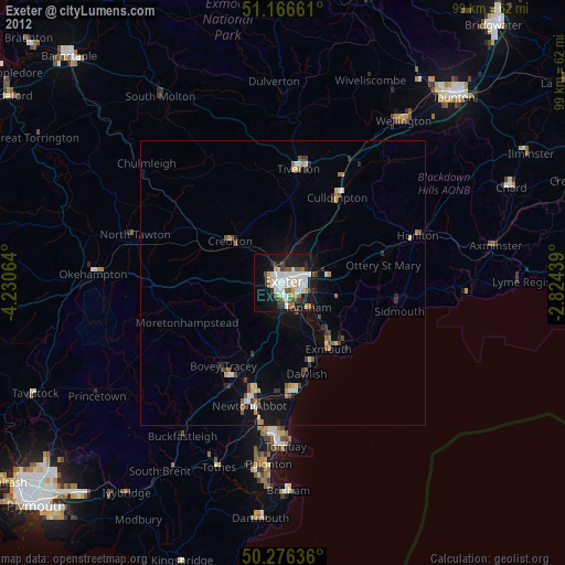
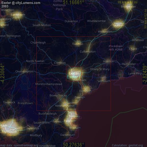
» NASA city lights 2003
» Earth at Night: Flat Maps 2012, 2016