Kingsteignton night lights from space
Night Light of Kingsteignton (England) from space (United Kingdom) Src. Average luminocity for 10x10km area is 14.7059% and for 50x50km: 4.6589%.
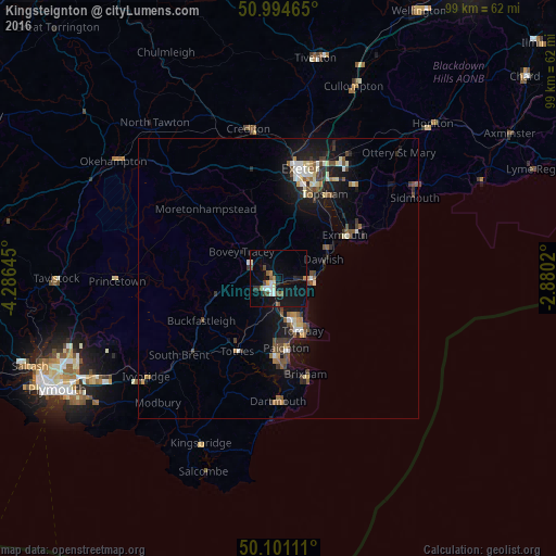
Analysis of Kingsteignton night lights 2016
Square area 10x10 km:
 1.34%
1.34%90-99
2.67%80-89
0.94%70-79
0.8%60-69
1.2%50-59
2.81%40-49
2.67%30-39
1.2%20-29
1.34%10-19
18.05%0-9
66.98%Square area 50x50 km:
0.44%90-99
0.71%80-89
0.46%70-79
0.33%60-69
0.53%50-59
0.84%40-49
0.88%30-39
0.68%20-29
0.78%10-19
4.54%0-9
89.79%Clear (daylight) street map image can be seen on geolist.org.
Map coordinates:
50° 59' 40.7" North, 4° 17' 11.2" West
50° 33' 0" North, 3° 34' 60" West
50° 6' 4" North, 2° 52' 48.7" West
Some cities around Kingsteignton sort by population:
• Torquay
10.6 km =6.6 mi,  157°
157°
• Paignton
12.8 km =8 mi,  175°
175°
• Newton Abbot
3.1 km =1.9 mi,  220°
220°
• Exmouth
14.8 km =9.2 mi,  59°
59°
• Teignmouth
6.1 km =3.8 mi,  92°
92°
• Dawlish
9 km =5.6 mi,  67°
67°
• Cockington
9.8 km =6.1 mi,  169°
169°
• Totnes
15 km =9.3 mi,  208°
208°
2645442 (p: 11,360)
Sources (retrieved 2019-11-25):
» Earth at Night: Flat Maps 2012, 2016