Crediton night lights from space
Night Light of Crediton (England) from space (United Kingdom) Src. Average luminocity for 10x10km area is 2.1919% and for 50x50km: 3.0546%.
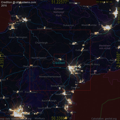
Analysis of Crediton night lights 2016
Square area 10x10 km:
 0%
0%90-99
0%80-89
0.56%70-79
0%60-69
0%50-59
1.68%40-49
1.12%30-39
0%20-29
0%10-19
0.14%0-9
96.5%Square area 50x50 km:
0.26%90-99
0.58%80-89
0.36%70-79
0.18%60-69
0.4%50-59
0.55%40-49
0.38%30-39
0.46%20-29
0.49%10-19
2.57%0-9
93.77%Clear (daylight) street map image can be seen on geolist.org.
Map coordinates:
51° 13' 32.8" North, 4° 21' 11.3" West
50° 46' 60" North, 3° 39' 0" West
50° 20' 12" North, 2° 56' 48.8" West
Some cities around Crediton sort by population:
• Exeter
10.9 km =6.8 mi,  127°
127°
• Exmouth
25.4 km =15.8 mi,  136°
136°
• Heavitree
12.9 km =8 mi,  122°
122°
• Tiverton
17.3 km =10.7 mi,  39°
39°
• Kingsteignton
26.4 km =16.4 mi,  169°
169°
• Dawlish
25.9 km =16.1 mi,  150°
150°
• Cullompton
19.8 km =12.3 mi,  66°
66°
• Okehampton
25.2 km =15.7 mi,  258°
258°
2652034 (p: 7,835)
Sources (retrieved 2019-11-25):
» Earth at Night: Flat Maps 2012, 2016