Erith night lights from space
Night Light of Erith (England) from space (United Kingdom) Src. Average luminocity for 10x10km area is 90.0201% and for 50x50km: 56.2438%.
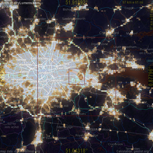
Analysis of Erith night lights 2016
Square area 10x10 km:
 34.09%
90-99
35.96%80-89
7.35%70-79
9.89%60-69
5.48%50-59
5.61%40-49
1.6%30-39
0%20-29
0%10-19
0%0-9
0%Square area 50x50 km:
21.49%90-99
12.34%80-89
5.66%70-79
4.88%60-69
5.07%50-59
4.7%40-49
4.72%30-39
5.61%20-29
9.08%10-19
11.57%0-9
14.87%Clear (daylight) street map image can be seen on geolist.org.
Map coordinates:
51° 55' 8.1" North, 0° 31' 41.8" West
51° 28' 59.3" North, 0° 10' 29.4" East
51° 2' 35.4" North, 0° 52' 40.7" East
Some cities around Erith sort by population:
• Bexley
5 km =3.1 mi,  201°
201°
• Dartford
4.9 km =3 mi,  146°
146°
• Welling
5.2 km =3.2 mi,  243°
243°
• Abbey Wood
4.7 km =2.9 mi,  275°
275°
• Purfleet
4.7 km =2.9 mi,  88°
88°
• Belvedere
1.9 km =1.2 mi,  298°
298°
• Aveley
5.6 km =3.5 mi,  70°
70°
• West Thurrock
7.1 km =4.4 mi, 94°
2649937 (p: 9,811)
Sources (retrieved 2019-11-25):
» Earth at Night: Flat Maps 2012, 2016