Abbey Wood night lights from space
Night Light of Abbey Wood (England) from space (United Kingdom) Src. Average luminocity for 10x10km area is 97.4906% and for 50x50km: 59.1535%.
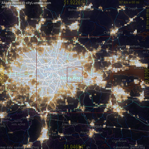
Analysis of Abbey Wood night lights 2016
Square area 10x10 km:
 51.2%
51.2%90-99
38.9%80-89
7.75%70-79
2.14%60-69
0%50-59
0%40-49
0%30-39
0%20-29
0%10-19
0%0-9
0%Square area 50x50 km:
24.06%90-99
12.81%80-89
5.8%70-79
4.85%60-69
5.32%50-59
5%40-49
4.99%30-39
4.93%20-29
8.55%10-19
9.93%0-9
13.77%Clear (daylight) street map image can be seen on geolist.org.
Map coordinates:
51° 55' 21.4" North, 0° 35' 44.3" West
51° 29' 12.8" North, 0° 6' 26.9" East
51° 2' 49" North, 0° 48' 38.2" East
Some cities around Abbey Wood sort by population:
• Bexley
5.8 km =3.6 mi,  150°
150°
• Becontree
7.5 km =4.7 mi,  11°
11°
• Barking
5.4 km =3.4 mi,  342°
342°
• Welling
2.7 km =1.7 mi,  179°
179°
• Blackheath
7.3 km =4.5 mi,  250°
250°
• Belvedere
3.1 km =1.9 mi,  81°
81°
• Sidcup
6.8 km =4.2 mi, 182°
• Erith
4.7 km =2.9 mi,  95°
95°
7302135 (p: 13,000)
Sources (retrieved 2019-11-25):
» Earth at Night: Flat Maps 2012, 2016