Dartford night lights from space
Night Light of Dartford (England) from space (United Kingdom) Src. Average luminocity for 10x10km area is 79.2447% and for 50x50km: 52.551%.
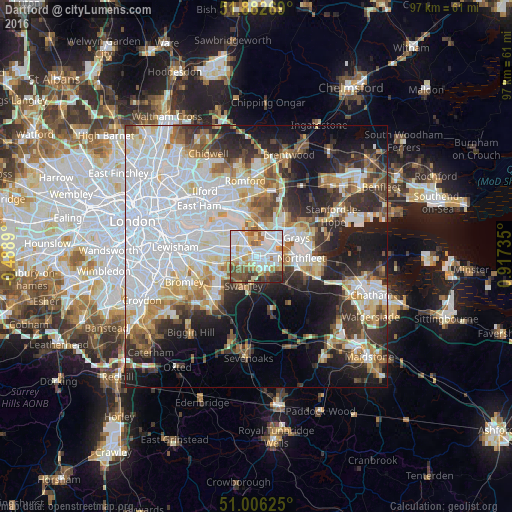
Analysis of Dartford night lights 2016
Square area 10x10 km:
 25.4%
25.4%90-99
25.4%80-89
8.29%70-79
9.63%60-69
5.75%50-59
9.63%40-49
7.09%30-39
4.95%20-29
3.88%10-19
0%0-9
0%Square area 50x50 km:
19.15%90-99
11.31%80-89
5.25%70-79
4.73%60-69
4.93%50-59
4.56%40-49
4.66%30-39
5.74%20-29
9.18%10-19
12.88%0-9
17.6%Clear (daylight) street map image can be seen on geolist.org.
Map coordinates:
51° 52' 57.7" North, 0° 29' 20" West
51° 26' 47.7" North, 0° 12' 51.2" East
51° 0' 22.5" North, 0° 55' 2.5" East
Some cities around Dartford sort by population:
• Bexley
4.6 km =2.9 mi,  263°
263°
• Swanley
6.2 km =3.9 mi,  207°
207°
• Purfleet
4.6 km =2.9 mi,  25°
25°
• Belvedere
6.6 km =4.1 mi,  318°
318°
• Erith
4.9 km =3 mi,  326°
326°
• Aveley
6.5 km =4 mi,  23°
23°
• West Thurrock
5.6 km =3.5 mi,  50°
50°
• Stone
3.5 km =2.2 mi,  83°
83°
2651500 (p: 56,694)
Sources (retrieved 2019-11-25):
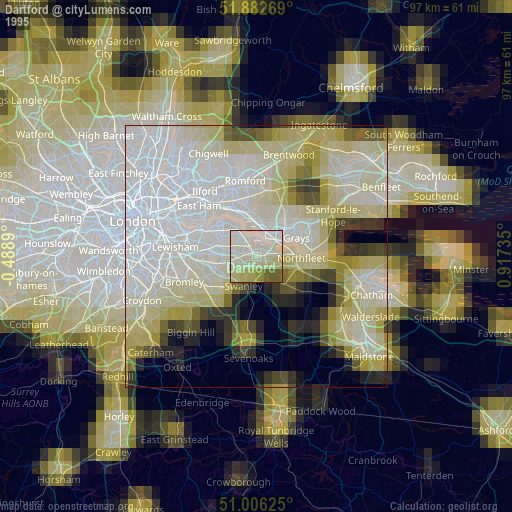
» NASA, Earths city lights 1995
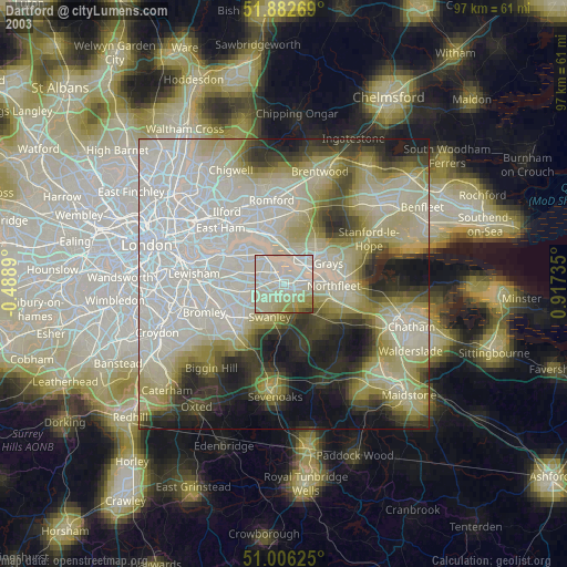
» NASA city lights 2003
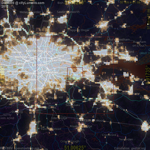
» Earth at Night: Flat Maps 2012, 2016