Aveley night lights from space
Night Light of Aveley (England) from space (United Kingdom) Src. Average luminocity for 10x10km area is 76.3636% and for 50x50km: 50.5319%.
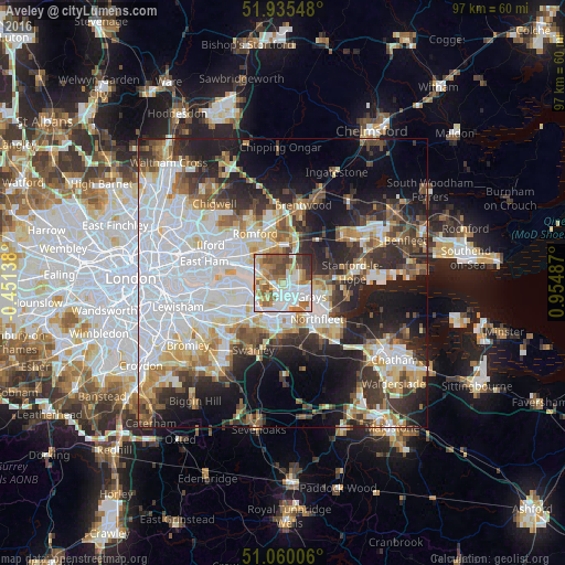
Analysis of Aveley night lights 2016
Square area 10x10 km:
 19.92%
90-99
22.46%80-89
8.29%70-79
8.96%60-69
13.24%50-59
12.57%40-49
8.42%30-39
4.14%20-29
2.01%10-19
0%0-9
0%Square area 50x50 km:
16.53%90-99
10.93%80-89
5.19%70-79
4.73%60-69
5.2%50-59
4.74%40-49
5.31%30-39
6.15%20-29
9.73%10-19
14.24%0-9
17.25%Clear (daylight) street map image can be seen on geolist.org.
Map coordinates:
51° 56' 7.7" North, 0° 27' 5" West
51° 29' 59.5" North, 0° 15' 6.3" East
51° 3' 36.2" North, 0° 57' 17.5" East
Some cities around Aveley sort by population:
• Grays
5.8 km =3.6 mi,  117°
117°
• South Ockendon
2.4 km =1.5 mi,  67°
67°
• Chafford Hundred
3.2 km =2 mi,  111°
111°
• Purfleet
1.9 km =1.2 mi,  199°
199°
• Upminster
6.2 km =3.9 mi,  2°
2°
• Erith
5.6 km =3.5 mi,  250°
250°
• West Thurrock
3 km =1.9 mi,  144°
144°
• Stone
5.6 km =3.5 mi,  170°
170°
2656759 (p: 7,986)
Sources (retrieved 2019-11-25):
» Earth at Night: Flat Maps 2012, 2016