Elland night lights from space
Night Light of Elland (England) from space (United Kingdom) Src. Average luminocity for 10x10km area is 67.7639% and for 50x50km: 38.5823%.
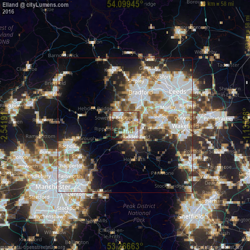
Analysis of Elland night lights 2016
Square area 10x10 km:
 15.4%
15.4%90-99
15.91%80-89
9.97%70-79
7.32%60-69
14.39%50-59
10.23%40-49
7.58%30-39
6.44%20-29
7.2%10-19
5.56%0-9
0%Square area 50x50 km:
11.21%90-99
9.17%80-89
3.26%70-79
4.02%60-69
4.61%50-59
4.7%40-49
3.89%30-39
4.44%20-29
6.77%10-19
10.58%0-9
37.34%Clear (daylight) street map image can be seen on geolist.org.
Map coordinates:
54° 5' 58" North, 2° 32' 30.9" West
53° 41' 6.4" North, 1° 50' 19.6" West
53° 15' 59.9" North, 1° 8' 8.4" West
Some cities around Elland sort by population:
• Huddersfield
5.4 km =3.4 mi,  138°
138°
• Halifax
3.6 km =2.2 mi,  348°
348°
• Brighouse
4.1 km =2.5 mi,  60°
60°
• Cleckheaton
9.3 km =5.8 mi, 62°
• Mirfield
9.5 km =5.9 mi,  97°
97°
• Rastrick
3.4 km =2.1 mi,  76°
76°
• Sowerby Bridge
5.4 km =3.4 mi,  299°
299°
• Queensbury
9.1 km =5.7 mi,  355°
355°
2650110 (p: 15,625)
Sources (retrieved 2019-11-25):
» Earth at Night: Flat Maps 2012, 2016