Sowerby Bridge night lights from space
Night Light of Sowerby Bridge (England) from space (United Kingdom) Src. Average luminocity for 10x10km area is 41.9154% and for 50x50km: 35.0869%.
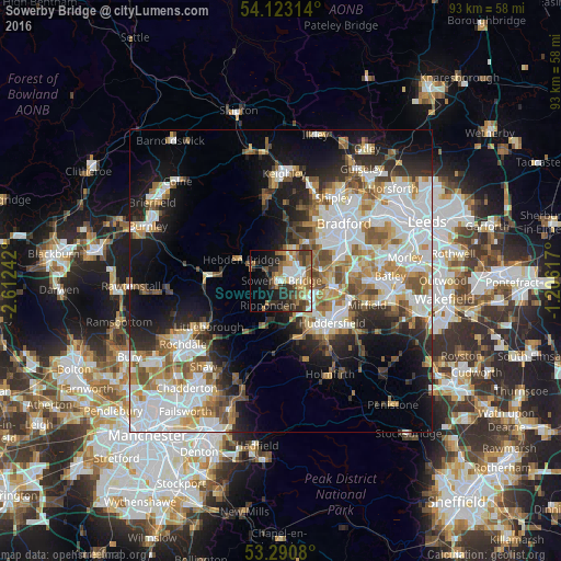
Analysis of Sowerby Bridge night lights 2016
Square area 10x10 km:
 6.06%
6.06%90-99
8.08%80-89
3.66%70-79
4.29%60-69
8.59%50-59
8.59%40-49
6.06%30-39
9.97%20-29
9.85%10-19
13.26%0-9
21.59%Square area 50x50 km:
9.52%90-99
7.83%80-89
2.84%70-79
3.91%60-69
4.73%50-59
4.67%40-49
3.56%30-39
3.65%20-29
6.28%10-19
12.3%0-9
40.72%Clear (daylight) street map image can be seen on geolist.org.
Map coordinates:
54° 7' 23.3" North, 2° 36' 44.7" West
53° 42' 32.5" North, 1° 54' 33.4" West
53° 17' 26.9" North, 1° 12' 22.2" West
Some cities around Sowerby Bridge sort by population:
• Huddersfield
10.6 km =6.6 mi,  128°
128°
• Halifax
4 km =2.5 mi,  77°
77°
• Brighouse
8.3 km =5.2 mi,  94°
94°
• Elland
5.4 km =3.4 mi,  119°
119°
• Todmorden
12.4 km =7.7 mi,  272°
272°
• Rastrick
8.2 km =5.1 mi,  103°
103°
• Queensbury
7.5 km =4.7 mi,  31°
31°
• Wilsden
12.9 km =8 mi,  14°
14°
2637268 (p: 9,948)
Sources (retrieved 2019-11-25):
» Earth at Night: Flat Maps 2012, 2016