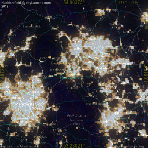
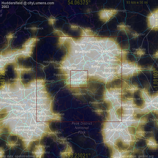
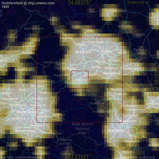
Huddersfield night lights from space
Night Light of Huddersfield (England) from space (United Kingdom) Src. Average luminocity for 10x10km area is 62.928% and for 50x50km: 39.7872%.
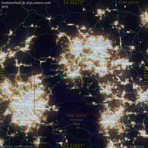
Analysis of Huddersfield night lights 2016
Square area 10x10 km:
 13.64%
90-99
14.65%80-89
9.22%70-79
5.3%60-69
13.01%50-59
7.95%40-49
6.94%30-39
8.08%20-29
15.91%10-19
5.3%0-9
0%Square area 50x50 km:
10.67%90-99
9.69%80-89
3.66%70-79
4.34%60-69
4.76%50-59
5.01%40-49
4.73%30-39
5.8%20-29
7.02%10-19
7.77%0-9
36.53%Clear (daylight) street map image can be seen on geolist.org.
Map coordinates:
54° 3' 49.5" North, 2° 29' 14.2" West
53° 38' 56.5" North, 1° 47' 3" West
53° 13' 48.8" North, 1° 4' 51.7" West
Some cities around Huddersfield sort by population:
• Brighouse
6 km =3.7 mi,  359°
359°
• Mirfield
6.4 km =4 mi,  64°
64°
• Elland
5.4 km =3.4 mi,  318°
318°
• Liversedge
8.6 km =5.3 mi,  43°
43°
• Rastrick
4.8 km =3 mi, 356°
• Meltham Mills
7.2 km =4.5 mi,  210°
210°
• Meltham
7.5 km =4.7 mi, 214°
• Shelley
8.6 km =5.3 mi,  129°
129°
2646458 (p: 149,017)
Sources (retrieved 2019-11-25):
» NASA, Earths city lights 1995
» NASA city lights 2003
» Earth at Night: Flat Maps 2012, 2016