East Kilbride night lights from space
Night Light of East Kilbride (Scotland) from space (United Kingdom) Src. Average luminocity for 10x10km area is 52.5419% and for 50x50km: 29.0393%.
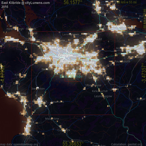
Analysis of East Kilbride night lights 2016
Square area 10x10 km:
 9.93%
9.93%90-99
11.36%80-89
6.46%70-79
4.19%60-69
6.94%50-59
8.25%40-49
13.04%30-39
5.62%20-29
15.79%10-19
16.51%0-9
1.91%Square area 50x50 km:
8.12%90-99
7.34%80-89
2%70-79
2.76%60-69
3.09%50-59
2.57%40-49
3.04%30-39
3.67%20-29
6.22%10-19
11.74%0-9
49.46%Clear (daylight) street map image can be seen on geolist.org.
Map coordinates:
56° 9' 27.7" North, 4° 52' 47.4" West
55° 45' 50.8" North, 4° 10' 36.1" West
55° 21' 59.5" North, 3° 28' 24.9" West
Some cities around East Kilbride sort by population:
• Rutherglen
7.6 km =4.7 mi,  342°
342°
• Cambuslang
5.2 km =3.2 mi,  10°
10°
• Blantyre
6.2 km =3.9 mi,  55°
55°
• High Blantyre
5.3 km =3.3 mi, 64°
• Giffnock
8.6 km =5.3 mi,  300°
300°
• Clarkston
6.7 km =4.2 mi,  291°
291°
• Bothwell
8 km =5 mi, 57°
• Uddingston
8.5 km =5.3 mi,  43°
43°
2650405 (p: 74,740)
Sources (retrieved 2019-11-25):
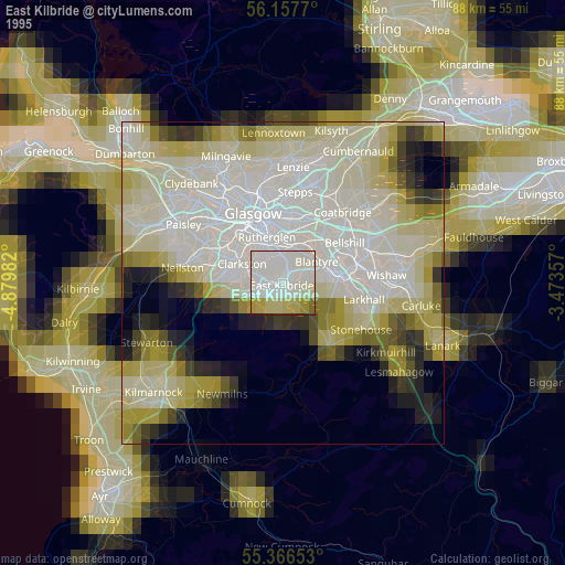
» NASA, Earths city lights 1995
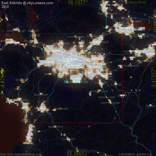
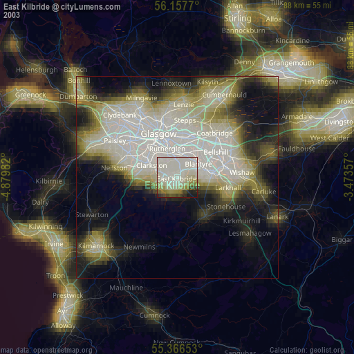
» NASA city lights 2003
» Earth at Night: Flat Maps 2012, 2016