Rutherglen night lights from space
Night Light of Rutherglen (Scotland) from space (United Kingdom) Src. Average luminocity for 10x10km area is 86.6352% and for 50x50km: 29.5803%.
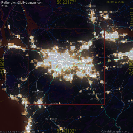
Analysis of Rutherglen night lights 2016
Square area 10x10 km:
 39.95%
90-99
25.96%80-89
7.54%70-79
4.55%60-69
6.46%50-59
4.07%40-49
10.29%30-39
1.2%20-29
0%10-19
0%0-9
0%Square area 50x50 km:
8.22%90-99
7.46%80-89
2.07%70-79
2.75%60-69
2.96%50-59
2.67%40-49
3.1%30-39
3.76%20-29
6.33%10-19
13.01%0-9
47.67%Clear (daylight) street map image can be seen on geolist.org.
Map coordinates:
56° 13' 18.4" North, 4° 55' 0.8" West
55° 49' 43.9" North, 4° 12' 49.5" West
55° 25' 54.9" North, 3° 30' 38.3" West
Some cities around Rutherglen sort by population:
• Glasgow
4.9 km =3 mi,  325°
325°
• East Kilbride
7.6 km =4.7 mi,  162°
162°
• Cambuslang
3.9 km =2.4 mi,  122°
122°
• Blantyre
8.3 km =5.2 mi, 115°
• Giffnock
5.8 km =3.6 mi,  241°
241°
• Clarkston
6.2 km =3.9 mi,  219°
219°
• Stepps
7.7 km =4.8 mi,  29°
29°
• Uddingston
8.2 km =5.1 mi,  97°
97°
2638926 (p: 31,180)
Sources (retrieved 2019-11-25):
» Earth at Night: Flat Maps 2012, 2016