Giffnock night lights from space
Night Light of Giffnock (Scotland) from space (United Kingdom) Src. Average luminocity for 10x10km area is 80.4378% and for 50x50km: 30.0188%.
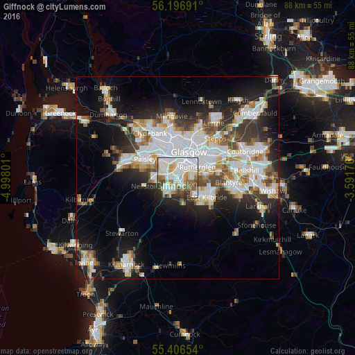
Analysis of Giffnock night lights 2016
Square area 10x10 km:
 29.67%
90-99
26.2%80-89
7.66%70-79
6.94%60-69
8.25%50-59
5.98%40-49
4.31%30-39
6.1%20-29
4.43%10-19
0.48%0-9
0%Square area 50x50 km:
8.28%90-99
7.53%80-89
2.26%70-79
2.89%60-69
3.04%50-59
2.79%40-49
3.08%30-39
3.68%20-29
6.09%10-19
12.89%0-9
47.47%Clear (daylight) street map image can be seen on geolist.org.
Map coordinates:
56° 11' 48.9" North, 4° 59' 52.8" West
55° 48' 13.4" North, 4° 17' 41.6" West
55° 24' 23.5" North, 3° 35' 30.3" West
Some cities around Giffnock sort by population:
• Glasgow
7.2 km =4.5 mi,  18°
18°
• East Kilbride
8.6 km =5.3 mi,  120°
120°
• Rutherglen
5.8 km =3.6 mi,  61°
61°
• Cambuslang
8.4 km =5.2 mi,  85°
85°
• Newton Mearns
4.1 km =2.5 mi,  215°
215°
• Barrhead
6.1 km =3.8 mi,  265°
265°
• Clarkston
2.3 km =1.4 mi,  149°
149°
• Neilston
8.5 km =5.3 mi,  256°
256°
2648683 (p: 12,070)
Sources (retrieved 2019-11-25):
» Earth at Night: Flat Maps 2012, 2016