Blantyre night lights from space
Night Light of Blantyre (Scotland) from space (United Kingdom) Src. Average luminocity for 10x10km area is 73.6711% and for 50x50km: 29.5133%.
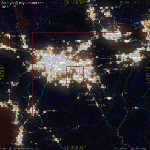
Analysis of Blantyre night lights 2016
Square area 10x10 km:
 19.02%
90-99
22.61%80-89
7.89%70-79
10.89%60-69
9.09%50-59
7.06%40-49
9.33%30-39
5.26%20-29
8.85%10-19
0%0-9
0%Square area 50x50 km:
8.41%90-99
7.64%80-89
2.01%70-79
2.84%60-69
2.99%50-59
2.55%40-49
3%30-39
3.72%20-29
6.32%10-19
10.93%0-9
49.6%Clear (daylight) street map image can be seen on geolist.org.
Map coordinates:
56° 11' 22.5" North, 4° 47' 52.7" West
55° 47' 46.8" North, 4° 5' 41.5" West
55° 23' 56.7" North, 3° 23' 30.2" West
Some cities around Blantyre sort by population:
• East Kilbride
6.2 km =3.9 mi,  235°
235°
• Hamilton
5.1 km =3.2 mi,  130°
130°
• Cambuslang
4.4 km =2.7 mi,  289°
289°
• Bellshill
5.4 km =3.4 mi,  65°
65°
• High Blantyre
1.4 km =0.9 mi,  193°
193°
• Viewpark
4.2 km =2.6 mi,  34°
34°
• Bothwell
1.8 km =1.1 mi, 66°
• Uddingston
2.7 km =1.7 mi,  15°
15°
11592111 (p: 17,090)
Sources (retrieved 2019-11-25):
» Earth at Night: Flat Maps 2012, 2016