Pontyclun night lights from space
Night Light of Pontyclun (Wales) from space (United Kingdom) Src. Average luminocity for 10x10km area is 14.4144% and for 50x50km: 16.2108%.
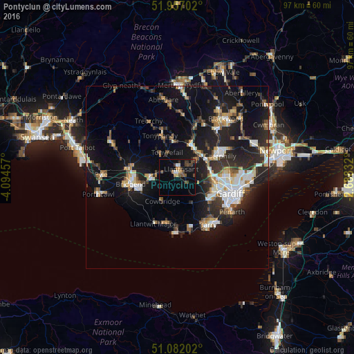
Analysis of Pontyclun night lights 2016
Square area 10x10 km:
 0.8%
0.8%90-99
1.34%80-89
0.53%70-79
1.07%60-69
2.14%50-59
1.87%40-49
5.21%30-39
3.88%20-29
0.27%10-19
14.71%0-9
68.18%Square area 50x50 km:
2.41%90-99
2.89%80-89
1.26%70-79
1.72%60-69
1.69%50-59
1.71%40-49
1.94%30-39
2.69%20-29
6.13%10-19
14.69%0-9
62.87%Clear (daylight) street map image can be seen on geolist.org.
Map coordinates:
51° 57' 25.3" North, 4° 5' 40.5" West
51° 31' 17.8" North, 3° 23' 29.2" West
51° 4' 55.3" North, 2° 41' 18" West
Some cities around Pontyclun sort by population:
• Coity
11.3 km =7 mi,  270°
270°
• Llantrisant
2.4 km =1.5 mi,  30°
30°
• Tonyrefail
7.4 km =4.6 mi,  338°
338°
• Pencoed
7.5 km =4.7 mi, 271°
• Beddau
4.3 km =2.7 mi, 32°
• Brynna
5.3 km =3.3 mi,  290°
290°
• Abertridwr
11.9 km =7.4 mi,  45°
45°
• Llanharan
3.8 km =2.4 mi,  299°
299°
8260052 (p: 5,794)
Sources (retrieved 2019-11-25):
» Earth at Night: Flat Maps 2012, 2016