Crowborough night lights from space
Night Light of Crowborough (England) from space (United Kingdom) Src. Average luminocity for 10x10km area is 0.9545% and for 50x50km: 8.6754%.
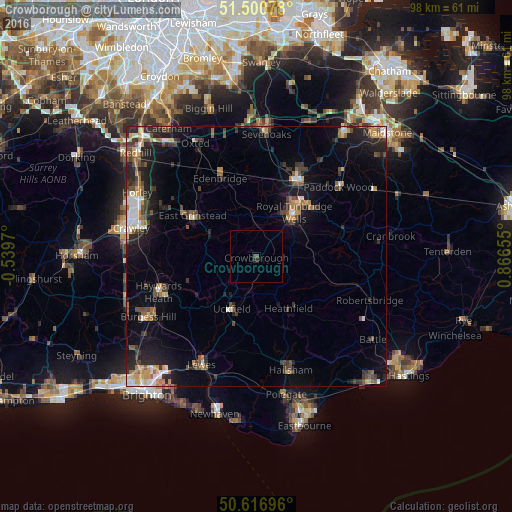
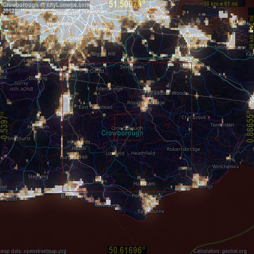
Analysis of Crowborough night lights 2016
Square area 10x10 km:
 0%
0%90-99
0%80-89
0%70-79
0%60-69
0%50-59
0%40-49
1.07%30-39
0%20-29
1.07%10-19
0.27%0-9
97.59%Square area 50x50 km:
0.87%90-99
1.15%80-89
0.61%70-79
1.1%60-69
1.1%50-59
1.35%40-49
1.7%30-39
1.78%20-29
2.84%10-19
5.67%0-9
81.85%Clear (daylight) street map image can be seen on geolist.org.
Map coordinates:
51° 30' 2.8" North, 0° 32' 22.9" West
51° 3' 39.5" North, 0° 9' 48.3" East
50° 37' 1.1" North, 0° 51' 59.6" East
Some cities around Crowborough sort by population:
• Royal Tunbridge Wells
10.6 km =6.6 mi,  40°
40°
• Tonbridge
16.8 km =10.4 mi,  27°
27°
• Haywards Heath
19.9 km =12.4 mi,  249°
249°
• East Grinstead
13.7 km =8.5 mi,  300°
300°
• Uckfield
11.2 km =7 mi,  204°
204°
• Edenbridge
16 km =9.9 mi,  335°
335°
• Paddock Wood
20.3 km =12.6 mi,  48°
48°
• Pembury
14.3 km =8.9 mi, 50°
2651852 (p: 20,607)
Sources (retrieved 2019-11-25):
» Earth at Night: Flat Maps 2012, 2016