Pembury night lights from space
Night Light of Pembury (England) from space (United Kingdom) Src. Average luminocity for 10x10km area is 17.2754% and for 50x50km: 8.8507%.
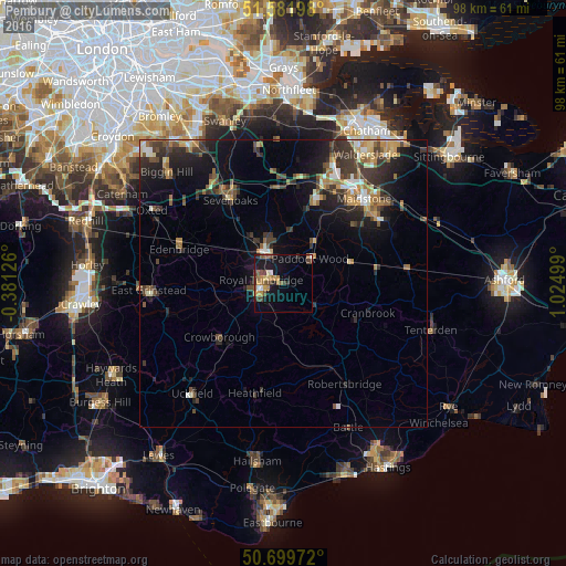
Analysis of Pembury night lights 2016
Square area 10x10 km:
 0.94%
0.94%90-99
1.2%80-89
1.6%70-79
2.94%60-69
3.61%50-59
4.55%40-49
3.74%30-39
2.01%20-29
2.41%10-19
15.64%0-9
61.36%Square area 50x50 km:
0.64%90-99
1.07%80-89
0.76%70-79
1.23%60-69
1.38%50-59
1.46%40-49
1.55%30-39
2.56%20-29
2.66%10-19
5.86%0-9
80.82%Clear (daylight) street map image can be seen on geolist.org.
Map coordinates:
51° 34' 55.1" North, 0° 22' 52.5" West
51° 8' 34.7" North, 0° 19' 18.7" East
50° 41' 59" North, 1° 1' 30" East
Some cities around Pembury sort by population:
• Royal Tunbridge Wells
4.3 km =2.7 mi,  255°
255°
• Tonbridge
6.7 km =4.2 mi,  329°
329°
• Sevenoaks
17.1 km =10.6 mi, 327°
• Crowborough
14.3 km =8.9 mi,  230°
230°
• Edenbridge
18.6 km =11.6 mi,  286°
286°
• Paddock Wood
6 km =3.7 mi,  44°
44°
• Kemsing
19.2 km =11.9 mi,  340°
340°
• Staplehurst
16.2 km =10.1 mi,  82°
82°
2640498 (p: 6,128)
Sources (retrieved 2019-11-25):
» Earth at Night: Flat Maps 2012, 2016