Okehampton night lights from space
Night Light of Okehampton (England) from space (United Kingdom) Src. Average luminocity for 10x10km area is 1.6631% and for 50x50km: 0.4167%.
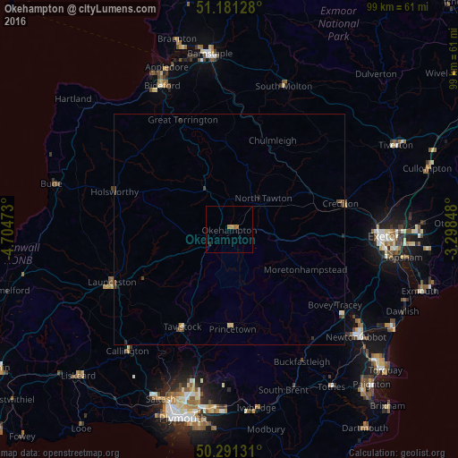
Analysis of Okehampton night lights 2016
Square area 10x10 km:
 0%
0%90-99
0%80-89
0%70-79
0.53%60-69
1.6%50-59
0%40-49
0%30-39
0%20-29
0.53%10-19
0%0-9
97.33%Square area 50x50 km:
0.01%90-99
0.04%80-89
0.05%70-79
0.04%60-69
0.07%50-59
0.11%40-49
0.17%30-39
0.04%20-29
0.14%10-19
0.04%0-9
99.28%Clear (daylight) street map image can be seen on geolist.org.
Map coordinates:
51° 10' 52.6" North, 4° 42' 17" West
50° 44' 18.3" North, 4° 0' 5.8" West
50° 17' 28.7" North, 3° 17' 54.5" West
Some cities around Okehampton sort by population:
• Exeter
33.4 km =20.8 mi,  92°
92°
• Bideford
34.2 km =21.3 mi,  334°
334°
• Tavistock
23.3 km =14.5 mi,  205°
205°
• Launceston
27.7 km =17.2 mi,  245°
245°
• Crediton
25.2 km =15.7 mi,  78°
78°
• Callington
34.3 km =21.3 mi,  219°
219°
• Great Torrington
25.9 km =16.1 mi,  337°
337°
• South Molton
33.1 km =20.6 mi,  20°
20°
2641049 (p: 7,647)
Sources (retrieved 2019-11-25):
» Earth at Night: Flat Maps 2012, 2016