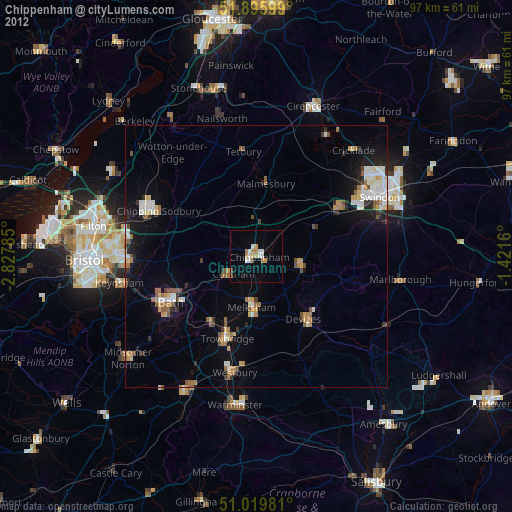
Chippenham night lights from space
Night Light of Chippenham (England) from space (United Kingdom) Src. Average luminocity for 10x10km area is 13.0963% and for 50x50km: 7.1161%.
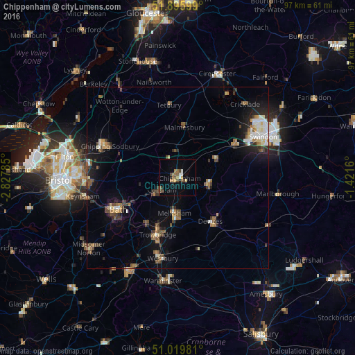
Analysis of Chippenham night lights 2016
Square area 10x10 km:
 1.07%
1.07%90-99
1.07%80-89
1.47%70-79
0.94%60-69
3.34%50-59
2.27%40-49
2.67%30-39
0.53%20-29
0.8%10-19
3.88%0-9
81.95%Square area 50x50 km:
0.74%90-99
1.04%80-89
0.55%70-79
0.71%60-69
1.06%50-59
1.11%40-49
1.37%30-39
0.89%20-29
1.7%10-19
4%0-9
86.84%Clear (daylight) street map image can be seen on geolist.org.
Map coordinates:
51° 53' 45.6" North, 2° 49' 40.3" West
51° 27' 36" North, 2° 7' 29" West
51° 1' 11.3" North, 1° 25' 17.8" West
Some cities around Chippenham sort by population:
• Melksham
9.8 km =6.1 mi,  186°
186°
• Devizes
15.1 km =9.4 mi,  143°
143°
• Calne
8.6 km =5.3 mi,  105°
105°
• Neston
7.5 km =4.7 mi,  224°
224°
• Corsham
5 km =3.1 mi,  235°
235°
• Bradford-on-Avon
15.2 km =9.4 mi,  214°
214°
• Malmesbury
13.7 km =8.5 mi,  8°
8°
• Lyneham
12.6 km =7.8 mi,  60°
60°
2653144 (p: 35,800)
Sources (retrieved 2019-11-25):
» Earth at Night: Flat Maps 2012, 2016