Devizes night lights from space
Night Light of Devizes (England) from space (United Kingdom) Src. Average luminocity for 10x10km area is 5.5588% and for 50x50km: 6.1782%.
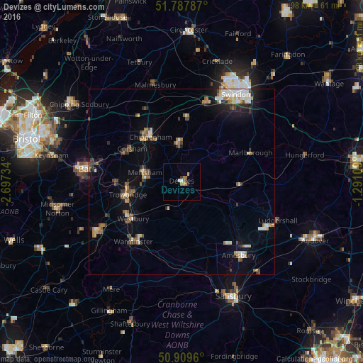
Analysis of Devizes night lights 2016
Square area 10x10 km:
 0.42%
0.42%90-99
0.7%80-89
0.14%70-79
1.26%60-69
2.1%50-59
0.42%40-49
0.56%30-39
0.56%20-29
0.84%10-19
0.28%0-9
92.72%Square area 50x50 km:
0.76%90-99
1%80-89
0.53%70-79
0.56%60-69
1.01%50-59
0.8%40-49
0.98%30-39
0.71%20-29
1.15%10-19
2.5%0-9
89.99%Clear (daylight) street map image can be seen on geolist.org.
Map coordinates:
51° 47' 16.3" North, 2° 41' 50.4" West
51° 21' 3" North, 1° 59' 39.2" West
50° 54' 34.6" North, 1° 17' 27.9" West
Some cities around Devizes sort by population:
• Trowbridge
15.3 km =9.5 mi,  256°
256°
• Chippenham
15.1 km =9.4 mi,  323°
323°
• Melksham
10.4 km =6.5 mi,  283°
283°
• Calne
9.8 km =6.1 mi,  355°
355°
• Westbury
16.8 km =10.4 mi,  233°
233°
• Neston
15.9 km =9.9 mi,  295°
295°
• Corsham
16.1 km =10 mi,  305°
305°
• Bradford-on-Avon
17.8 km =11.1 mi,  268°
268°
2651294 (p: 18,064)
Sources (retrieved 2019-11-25):
» Earth at Night: Flat Maps 2012, 2016