Chesterfield night lights from space
Night Light of Chesterfield (England) from space (United Kingdom) Src. Average luminocity for 10x10km area is 41.1881% and for 50x50km: 22.3731%.
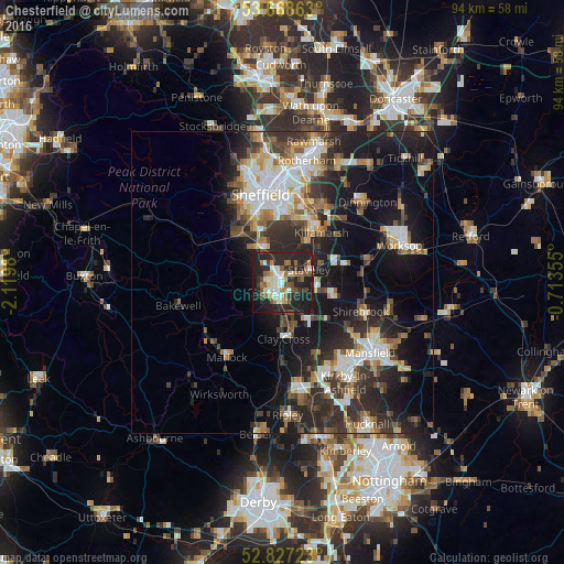
Analysis of Chesterfield night lights 2016
Square area 10x10 km:
 5.56%
5.56%90-99
7.95%80-89
3.79%70-79
2.53%60-69
6.44%50-59
7.32%40-49
4.17%30-39
5.18%20-29
30.93%10-19
23.99%0-9
2.15%Square area 50x50 km:
3.39%90-99
4.23%80-89
2.1%70-79
2.15%60-69
2.81%50-59
3.03%40-49
3.14%30-39
4.42%20-29
8.83%10-19
14.77%0-9
51.12%Clear (daylight) street map image can be seen on geolist.org.
Map coordinates:
53° 40' 7.1" North, 2° 7' 11.3" West
53° 15' 0" North, 1° 25' 0" West
52° 49' 38" North, 0° 42' 48.8" West
Some cities around Chesterfield sort by population:
• Staveley
4.8 km =3 mi,  67°
67°
• Dronfield
7 km =4.3 mi,  326°
326°
• Bolsover
8.6 km =5.3 mi,  106°
106°
• Beighton
10.8 km =6.7 mi,  30°
30°
• Killamarsh
10.6 km =6.6 mi,  38°
38°
• Clowne
10.5 km =6.5 mi, 74°
• Wingerworth
5.5 km =3.4 mi,  191°
191°
• Creswell
13.2 km =8.2 mi,  83°
83°
2653225 (p: 113,057)
Sources (retrieved 2019-11-25):
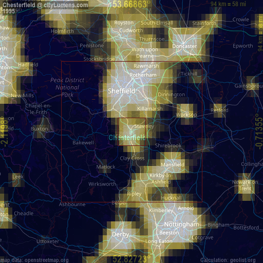
» NASA, Earths city lights 1995
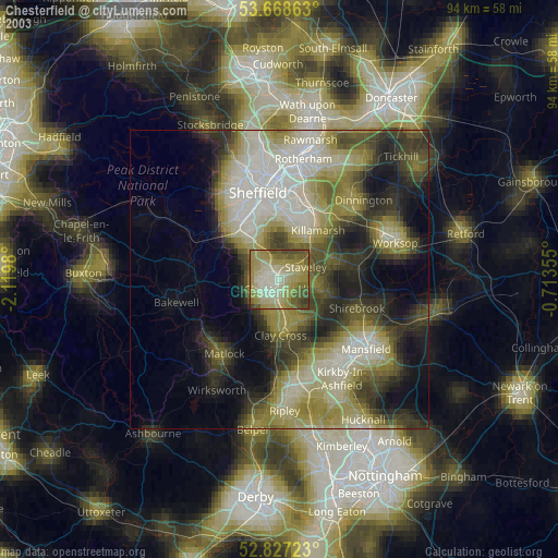
» NASA city lights 2003
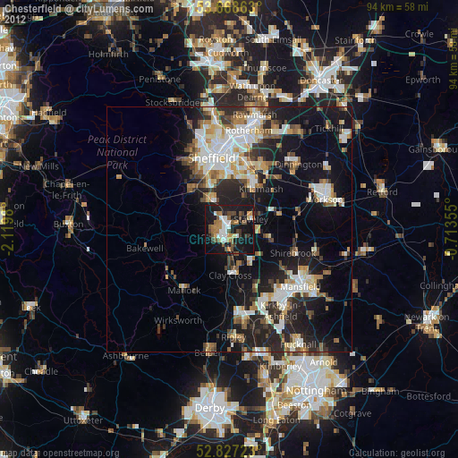
» Earth at Night: Flat Maps 2012, 2016