Cheam night lights from space
Night Light of Cheam (England) from space (United Kingdom) Src. Average luminocity for 10x10km area is 77.2605% and for 50x50km: 55.327%.
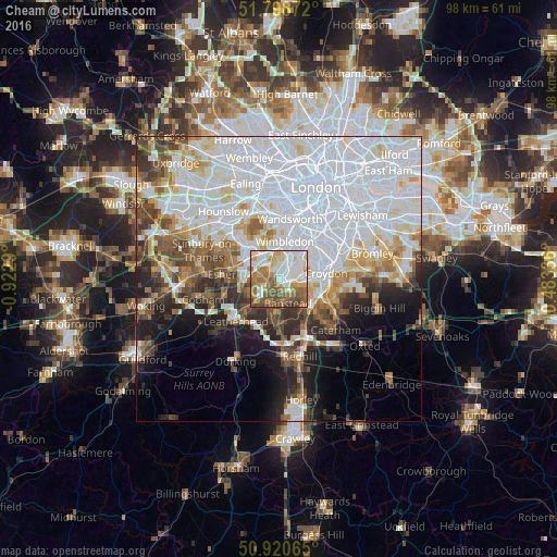
Analysis of Cheam night lights 2016
Square area 10x10 km:
 17.79%
90-99
20.73%80-89
8.96%70-79
12.46%60-69
16.81%50-59
13.87%40-49
7.84%30-39
1.54%20-29
0%10-19
0%0-9
0%Square area 50x50 km:
24.16%90-99
12.63%80-89
4.51%70-79
4.25%60-69
4.57%50-59
4.42%40-49
5.05%30-39
4.58%20-29
5.04%10-19
7.12%0-9
23.67%Clear (daylight) street map image can be seen on geolist.org.
Map coordinates:
51° 47' 55.4" North, 0° 55' 22.4" West
51° 21' 42.4" North, 0° 13' 11.2" West
50° 55' 14.3" North, 0° 29' 0.1" East
Some cities around Cheam sort by population:
• Sutton
1.9 km =1.2 mi,  133°
133°
• Morden
4.3 km =2.7 mi,  20°
20°
• Banstead
4.5 km =2.8 mi,  168°
168°
• Carshalton
3.7 km =2.3 mi,  78°
78°
• Ewell
2.5 km =1.6 mi,  236°
236°
• Epsom
4.9 km =3 mi,  225°
225°
• New Malden
5.2 km =3.2 mi,  326°
326°
• Worcester Park
2.6 km =1.6 mi,  319°
319°
2653289 (p: 11,286)
Sources (retrieved 2019-11-25):
» Earth at Night: Flat Maps 2012, 2016