Worcester Park night lights from space
Night Light of Worcester Park (England) from space (United Kingdom) Src. Average luminocity for 10x10km area is 84.6709% and for 50x50km: 57.5739%.
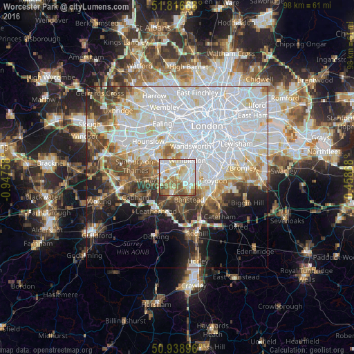
Analysis of Worcester Park night lights 2016
Square area 10x10 km:
 28.15%
90-99
26.33%80-89
10.08%70-79
9.8%60-69
14.29%50-59
7.98%40-49
2.66%30-39
0.7%20-29
0%10-19
0%0-9
0%Square area 50x50 km:
25.11%90-99
13.01%80-89
4.7%70-79
4.38%60-69
4.78%50-59
4.83%40-49
5.21%30-39
4.91%20-29
5.41%10-19
7.42%0-9
20.23%Clear (daylight) street map image can be seen on geolist.org.
Map coordinates:
51° 49' 0" North, 0° 56' 51.3" West
51° 22' 47.7" North, 0° 14' 40" West
50° 56' 20.3" North, 0° 27' 31.2" East
Some cities around Worcester Park sort by population:
• Sutton
4.5 km =2.8 mi,  137°
137°
• Morden
3.8 km =2.4 mi,  57°
57°
• Ewell
3.4 km =2.1 mi,  185°
185°
• Surbiton
3.9 km =2.4 mi,  288°
288°
• New Malden
2.6 km =1.6 mi,  332°
332°
• Chessington
4.6 km =2.9 mi,  244°
244°
• Hook
4.5 km =2.8 mi,  252°
252°
• Cheam
2.6 km =1.6 mi, 139°
2633561 (p: 16,031)
Sources (retrieved 2019-11-25):
» Earth at Night: Flat Maps 2012, 2016