Epsom night lights from space
Night Light of Epsom (England) from space (United Kingdom) Src. Average luminocity for 10x10km area is 56.2353% and for 50x50km: 49.2698%.
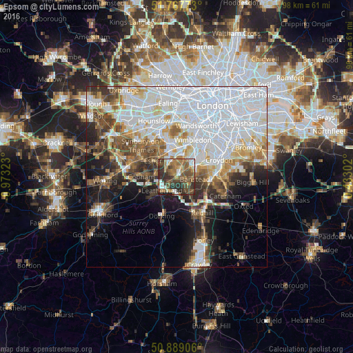
Analysis of Epsom night lights 2016
Square area 10x10 km:
100  6.3%
6.3%
90-99 7.7%
80-89 3.92%
70-79 6.44%
60-69 16.25%
50-59 15.27%
40-49 16.95%
30-39 14.85%
20-29 11.2%
10-19 1.12%
0-9 0%
6.3%90-99
7.7%80-89
3.92%70-79
6.44%60-69
16.25%50-59
15.27%40-49
16.95%30-39
14.85%20-29
11.2%10-19
1.12%0-9
0%Square area 50x50 km:
100 19.94%
90-99 10.26%
80-89 3.94%
70-79 4.18%
60-69 4.68%
50-59 4.95%
40-49 5.28%
30-39 4.68%
20-29 5.77%
10-19 9.11%
0-9 27.21%
19.94%90-99
10.26%80-89
3.94%70-79
4.18%60-69
4.68%50-59
4.95%40-49
5.28%30-39
4.68%20-29
5.77%10-19
9.11%0-9
27.21%Clear (daylight) street map image can be seen on geolist.org.
Map coordinates:
51° 46' 3.8" North, 0° 58' 23.6" West
51° 19' 49.8" North, 0° 16' 12.4" West
50° 53' 20.6" North, 0° 25' 58.9" East
Some cities around Epsom sort by population:
• Sutton
5.3 km =3.3 mi,  65°
65°
• Banstead
4.5 km =2.8 mi,  101°
101°
• Ewell
2.6 km =1.6 mi,  34°
34°
• Chessington
4.3 km =2.7 mi,  326°
326°
• Hook
4.9 km =3 mi, 328°
• Ashtead
3.2 km =2 mi,  220°
220°
• Cheam
4.9 km =3 mi,  45°
45°
• Tadworth
4.9 km =3 mi,  151°
151°
2649957 (p: 27,065)
Sources (retrieved 2019-11-25):
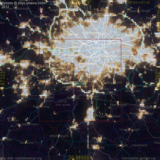
» Earth at Night: Flat Maps 2012, 2016