Carterton night lights from space
Night Light of Carterton (England) from space (United Kingdom) Src. Average luminocity for 10x10km area is 15.5868% and for 50x50km: 9.0634%.
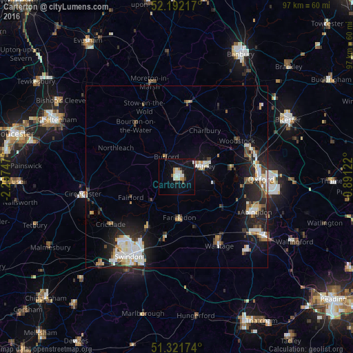
Analysis of Carterton night lights 2016
Square area 10x10 km:
 2.38%
2.38%90-99
4.48%80-89
0.42%70-79
1.96%60-69
0.84%50-59
0.56%40-49
0.98%30-39
1.4%20-29
1.26%10-19
15.55%0-9
70.17%Square area 50x50 km:
1.51%90-99
2.15%80-89
0.74%70-79
0.78%60-69
0.97%50-59
0.72%40-49
1.15%30-39
0.85%20-29
2.96%10-19
6.09%0-9
82.08%Clear (daylight) street map image can be seen on geolist.org.
Map coordinates:
52° 11' 31.8" North, 2° 17' 50.9" West
51° 45' 32.6" North, 1° 35' 39.7" West
51° 19' 18.3" North, 0° 53' 28.4" West
Some cities around Carterton sort by population:
• Oxford
23.3 km =14.5 mi,  91°
91°
• Witney
8 km =5 mi,  69°
69°
• Wantage
22.3 km =13.9 mi,  148°
148°
• Grove
20.4 km =12.7 mi,  144°
144°
• Kidlington
22.2 km =13.8 mi, 71°
• Highworth
16.4 km =10.2 mi,  209°
209°
• Faringdon
11.4 km =7.1 mi,  177°
177°
• Chipping Norton
20.5 km =12.7 mi,  9°
9°
2653634 (p: 16,364)
Sources (retrieved 2019-11-25):
» Earth at Night: Flat Maps 2012, 2016