Chipping Norton night lights from space
Night Light of Chipping Norton (England) from space (United Kingdom) Src. Average luminocity for 10x10km area is 1.7664% and for 50x50km: 5.7247%.
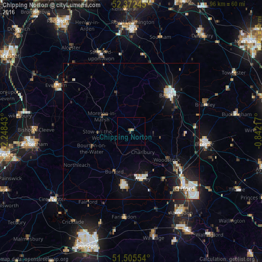
Analysis of Chipping Norton night lights 2016
Square area 10x10 km:
 0%
0%90-99
0%80-89
0.51%70-79
0.51%60-69
0%50-59
0.51%40-49
1.01%30-39
0%20-29
0%10-19
0.51%0-9
96.97%Square area 50x50 km:
0.9%90-99
1.42%80-89
0.47%70-79
0.41%60-69
0.39%50-59
0.55%40-49
0.69%30-39
0.61%20-29
1.48%10-19
4.21%0-9
88.87%Clear (daylight) street map image can be seen on geolist.org.
Map coordinates:
52° 22' 20.8" North, 2° 14' 54.3" West
51° 56' 27.9" North, 1° 32' 43.1" West
51° 30' 19.9" North, 0° 50' 31.8" West
Some cities around Chipping Norton sort by population:
• Banbury
19.4 km =12.1 mi,  45°
45°
• Bicester
27.2 km =16.9 mi,  99°
99°
• Witney
18 km =11.2 mi,  166°
166°
• Carterton
20.5 km =12.7 mi,  189°
189°
• Kidlington
22.1 km =13.7 mi,  127°
127°
• Wellesbourne Mountford
28.3 km =17.6 mi,  351°
351°
• Wellesbourne
28.6 km =17.8 mi, 353°
• Shipston on Stour
14.4 km =8.9 mi,  336°
336°
2653139 (p: 5,719)
Sources (retrieved 2019-11-25):
» Earth at Night: Flat Maps 2012, 2016