Burnham-on-Crouch night lights from space
Night Light of Burnham-on-Crouch (England) from space (United Kingdom) Src. Average luminocity for 10x10km area is 1.3922% and for 50x50km: 10.5214%.
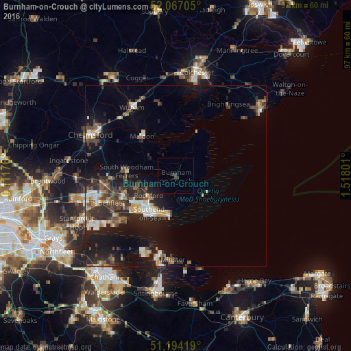
Analysis of Burnham-on-Crouch night lights 2016
Square area 10x10 km:
 0%
0%90-99
0%80-89
0%70-79
0%60-69
0%50-59
0%40-49
0%30-39
1.96%20-29
0.42%10-19
0.7%0-9
96.92%Square area 50x50 km:
1.08%90-99
1.46%80-89
0.92%70-79
1.16%60-69
1.18%50-59
1.41%40-49
2.04%30-39
2.25%20-29
3.83%10-19
9.14%0-9
75.52%Clear (daylight) street map image can be seen on geolist.org.
Map coordinates:
52° 4' 1.4" North, 0° 6' 42.3" East
51° 37' 57.8" North, 0° 48' 53.6" East
51° 11' 39.1" North, 1° 31' 4.8" East
Some cities around Burnham-on-Crouch sort by population:
• Southend-on-Sea
12.6 km =7.8 mi,  213°
213°
• Rayleigh
15.4 km =9.6 mi,  250°
250°
• Maldon
14.6 km =9.1 mi,  318°
318°
• Hadleigh
16.7 km =10.4 mi,  237°
237°
• Rochford
9.4 km =5.8 mi,  232°
232°
• West Mersea
17.7 km =11 mi,  23°
23°
• Danbury
18.5 km =11.5 mi,  300°
300°
• Great Wakering
9 km =5.6 mi,  184°
184°
2654270 (p: 7,561)
Sources (retrieved 2019-11-25):
» Earth at Night: Flat Maps 2012, 2016