Southend-on-Sea night lights from space
Night Light of Southend-on-Sea (England) from space (United Kingdom) Src. Average luminocity for 10x10km area is 41.7299% and for 50x50km: 18.0635%.
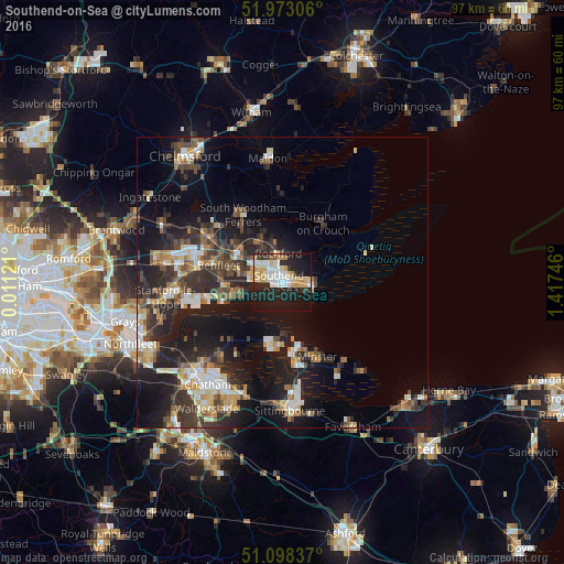
Analysis of Southend-on-Sea night lights 2016
Square area 10x10 km:
 6.28%
6.28%90-99
10.56%80-89
8.16%70-79
7.62%60-69
1.6%50-59
0.94%40-49
1.47%30-39
2.14%20-29
17.51%10-19
36.1%0-9
7.62%Square area 50x50 km:
2.11%90-99
2.96%80-89
2.04%70-79
2.09%60-69
2.08%50-59
1.98%40-49
3.05%30-39
3.83%20-29
6.94%10-19
14.53%0-9
58.37%Clear (daylight) street map image can be seen on geolist.org.
Map coordinates:
51° 58' 23" North, 0° 0' 40.4" East
51° 32' 16.2" North, 0° 42' 51.6" East
51° 5' 54.1" North, 1° 25' 2.9" East
Some cities around Southend-on-Sea sort by population:
• Canvey Island
9.4 km =5.8 mi,  259°
259°
• Rayleigh
9.3 km =5.8 mi,  305°
305°
• Pitsea
14.5 km =9 mi,  281°
281°
• Hadleigh
7.4 km =4.6 mi, 282°
• Rochford
4.9 km =3 mi,  353°
353°
• Sheerness
11.3 km =7 mi,  162°
162°
• Burnham-on-Crouch
12.6 km =7.8 mi,  33°
33°
• Great Wakering
6.4 km =4 mi,  75°
75°
2637433 (p: 295,310)
Sources (retrieved 2019-11-25):
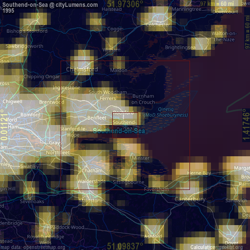
» NASA, Earths city lights 1995
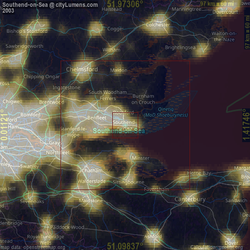
» NASA city lights 2003
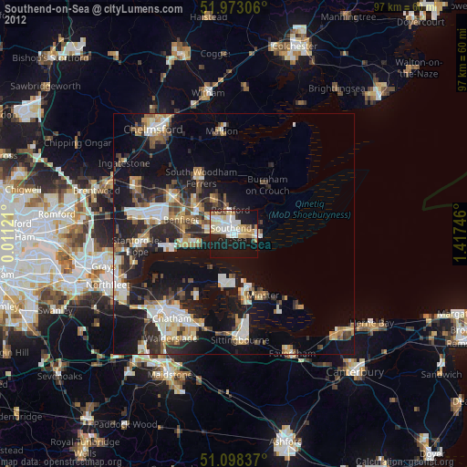
» Earth at Night: Flat Maps 2012, 2016