East Wittering night lights from space
Night Light of East Wittering (England) from space (United Kingdom) Src. Average luminocity for 10x10km area is 1.112% and for 50x50km: 7.8538%.
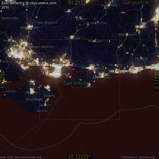
Analysis of East Wittering night lights 2016
Square area 10x10 km:
 0%
0%90-99
0%80-89
0%70-79
0%60-69
0%50-59
0%40-49
0%30-39
0.98%20-29
0.7%10-19
0%0-9
98.32%Square area 50x50 km:
0.96%90-99
1.23%80-89
0.52%70-79
0.8%60-69
0.94%50-59
1.23%40-49
1.54%30-39
1.8%20-29
2.23%10-19
5.42%0-9
83.33%Clear (daylight) street map image can be seen on geolist.org.
Map coordinates:
51° 12' 44.1" North, 1° 34' 39.2" West
50° 46' 10.9" North, 0° 52' 28" West
50° 19' 22.4" North, 0° 10' 16.7" West
Some cities around East Wittering sort by population:
• Bognor Regis
13.8 km =8.6 mi,  84°
84°
• Havant
12.4 km =7.7 mi,  321°
321°
• Chichester
10 km =6.2 mi,  41°
41°
• Emsworth
9.7 km =6 mi,  333°
333°
• Southsea
15.1 km =9.4 mi,  279°
279°
• Hayling Island
6.8 km =4.2 mi, 283°
• South Hayling
7.5 km =4.7 mi,  285°
285°
• Selsey
7.1 km =4.4 mi,  122°
122°
2650311 (p: 5,647)
Sources (retrieved 2019-11-25):
» Earth at Night: Flat Maps 2012, 2016