Bircotes night lights from space
Night Light of Bircotes (England) from space (United Kingdom) Src. Average luminocity for 10x10km area is 14.619% and for 50x50km: 21.5764%.
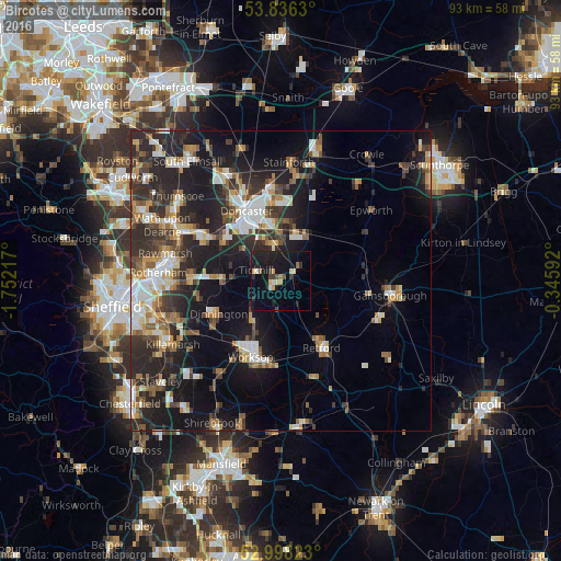
Analysis of Bircotes night lights 2016
Square area 10x10 km:
 0.66%
0.66%90-99
0.93%80-89
2.65%70-79
1.46%60-69
0.79%50-59
0.93%40-49
1.85%30-39
2.12%20-29
3.44%10-19
26.32%0-9
58.86%Square area 50x50 km:
3.11%90-99
3.51%80-89
2.18%70-79
2.46%60-69
2.5%50-59
2.9%40-49
2.79%30-39
4.1%20-29
9.08%10-19
15.01%0-9
52.35%Clear (daylight) street map image can be seen on geolist.org.
Map coordinates:
53° 50' 10.7" North, 1° 45' 7.8" West
53° 25' 9.6" North, 1° 2' 56.6" West
52° 59' 53.6" North, 0° 20' 45.3" West
Some cities around Bircotes sort by population:
• Doncaster
12.7 km =7.9 mi,  334°
334°
• Worksop
14 km =8.7 mi,  200°
200°
• Bentley
14.3 km =8.9 mi, 332°
• Retford
12.9 km =8 mi,  146°
146°
• Dinnington
11.6 km =7.2 mi,  239°
239°
• Maltby
10 km =6.2 mi,  268°
268°
• Conisbrough
14 km =8.7 mi,  299°
299°
• Armthorpe
12.9 km =8 mi,  358°
358°
2655624 (p: 7,948)
Sources (retrieved 2019-11-25):
» Earth at Night: Flat Maps 2012, 2016