Bentley night lights from space
Night Light of Bentley (England) from space (United Kingdom) Src. Average luminocity for 10x10km area is 62.5595% and for 50x50km: 31.0377%.
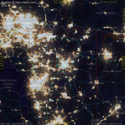
Analysis of Bentley night lights 2016
Square area 10x10 km:
 19.31%
90-99
18.65%80-89
3.57%70-79
5.03%60-69
3.44%50-59
5.95%40-49
7.54%30-39
10.32%20-29
20.5%10-19
5.69%0-9
0%Square area 50x50 km:
6.07%90-99
6.45%80-89
3.18%70-79
3.26%60-69
3.21%50-59
3.91%40-49
3.91%30-39
6.32%20-29
10.29%10-19
12.74%0-9
40.67%Clear (daylight) street map image can be seen on geolist.org.
Map coordinates:
53° 56' 57" North, 1° 51' 11.3" West
53° 31' 60" North, 1° 9' 0" West
53° 6' 48.1" North, 0° 26' 48.8" West
Some cities around Bentley sort by population:
• Doncaster
1.7 km =1.1 mi,  133°
133°
• Adwick le Street
4.7 km =2.9 mi,  331°
331°
• Conisbrough
7.9 km =4.9 mi,  223°
223°
• Mexborough
10.4 km =6.5 mi,  245°
245°
• Kirk Sandall
6.2 km =3.9 mi,  59°
59°
• Armthorpe
6.4 km =4 mi,  88°
88°
• Carcroft
5.8 km =3.6 mi,  342°
342°
• Askern
9.2 km =5.7 mi,  359°
359°
2655882 (p: 34,821)
Sources (retrieved 2019-11-25):
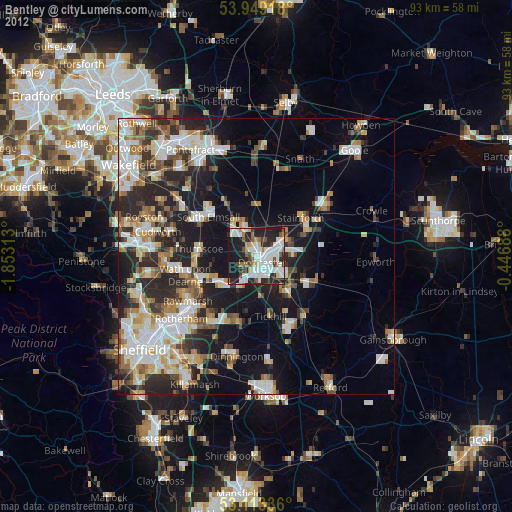
» Earth at Night: Flat Maps 2012, 2016