Doncaster night lights from space
Night Light of Doncaster (England) from space (United Kingdom) Src. Average luminocity for 10x10km area is 67.3452% and for 50x50km: 29.6067%.
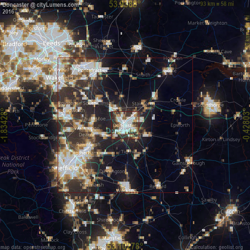
Analysis of Doncaster night lights 2016
Square area 10x10 km:
 19.44%
90-99
19.71%80-89
4.89%70-79
6.48%60-69
5.16%50-59
7.8%40-49
8.47%30-39
15.87%20-29
12.17%10-19
0%0-9
0%Square area 50x50 km:
5.63%90-99
6.03%80-89
3.06%70-79
3.18%60-69
3.11%50-59
3.76%40-49
3.68%30-39
6.06%20-29
10.09%10-19
12.31%0-9
43.08%Clear (daylight) street map image can be seen on geolist.org.
Map coordinates:
53° 56' 19.7" North, 1° 50' 3.4" West
53° 31' 22.3" North, 1° 7' 52.2" West
53° 6' 10" North, 0° 25' 40.9" West
Some cities around Doncaster sort by population:
• Bentley
1.7 km =1.1 mi,  313°
313°
• Adwick le Street
6.4 km =4 mi,  326°
326°
• Conisbrough
8.1 km =5 mi,  235°
235°
• Kirk Sandall
6 km =3.7 mi,  43°
43°
• Armthorpe
5.3 km =3.3 mi,  75°
75°
• Carcroft
7.3 km =4.5 mi,  335°
335°
• Stainforth
10.7 km =6.6 mi, 36°
• Askern
10.5 km =6.5 mi,  352°
352°
2651123 (p: 158,141)
Sources (retrieved 2019-11-25):
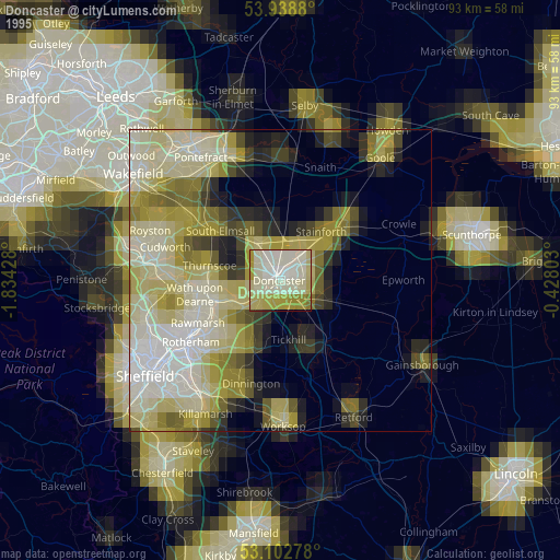
» NASA, Earths city lights 1995
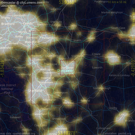
» NASA city lights 2003
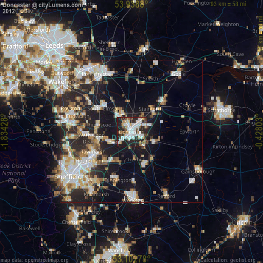
» Earth at Night: Flat Maps 2012, 2016