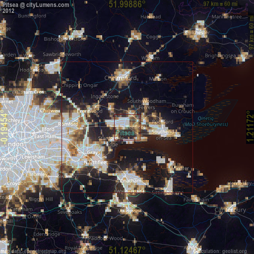
Pitsea night lights from space
Night Light of Pitsea (England) from space (United Kingdom) Src. Average luminocity for 10x10km area is 54.1377% and for 50x50km: 28.3879%.
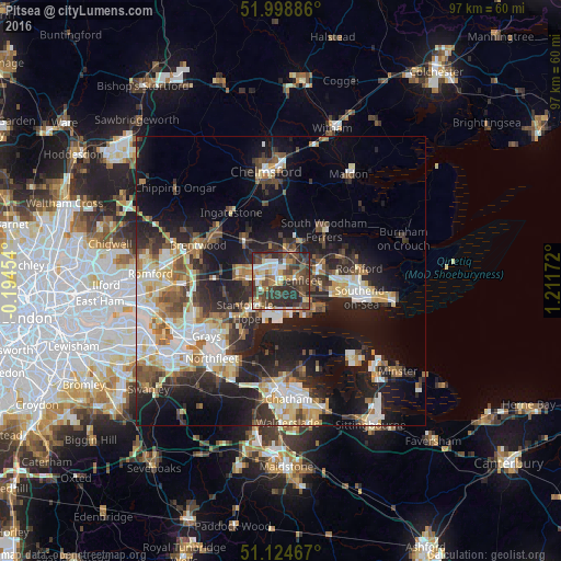
Analysis of Pitsea night lights 2016
Square area 10x10 km:
 7.22%
7.22%90-99
8.16%80-89
6.82%70-79
4.95%60-69
7.75%50-59
9.76%40-49
16.71%30-39
20.72%20-29
17.51%10-19
0.4%0-9
0%Square area 50x50 km:
4.57%90-99
5.62%80-89
3.36%70-79
3.4%60-69
3.26%50-59
3.49%40-49
4.13%30-39
4.36%20-29
8.95%10-19
17.1%0-9
41.78%Clear (daylight) street map image can be seen on geolist.org.
Map coordinates:
51° 59' 55.9" North, 0° 11' 40.3" West
51° 33' 49.9" North, 0° 30' 30.9" East
51° 7' 28.8" North, 1° 12' 42.2" East
Some cities around Pitsea sort by population:
• Basildon
3.5 km =2.2 mi,  278°
278°
• South Benfleet
3.7 km =2.3 mi,  108°
108°
• Canvey Island
6.8 km =4.2 mi,  132°
132°
• Billericay
9.5 km =5.9 mi,  319°
319°
• Wickford
5.3 km =3.3 mi,  10°
10°
• Rayleigh
7.1 km =4.4 mi,  69°
69°
• Stanford-le-Hope
6.9 km =4.3 mi,  228°
228°
• Hadleigh
7.1 km =4.4 mi,  100°
100°
2640246 (p: 25,000)
Sources (retrieved 2019-11-25):
» Earth at Night: Flat Maps 2012, 2016