Biddulph night lights from space
Night Light of Biddulph (England) from space (United Kingdom) Src. Average luminocity for 10x10km area is 22.5331% and for 50x50km: 14.6226%.
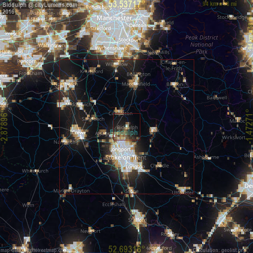
Analysis of Biddulph night lights 2016
Square area 10x10 km:
 0.53%
0.53%90-99
0.79%80-89
2.38%70-79
1.46%60-69
3.7%50-59
6.75%40-49
5.95%30-39
5.42%20-29
11.64%10-19
23.81%0-9
37.57%Square area 50x50 km:
2.54%90-99
2.49%80-89
1.42%70-79
1.25%60-69
1.47%50-59
1.95%40-49
1.87%30-39
2.01%20-29
4.44%10-19
12.48%0-9
68.07%Clear (daylight) street map image can be seen on geolist.org.
Map coordinates:
53° 32' 13.8" North, 2° 52' 44.3" West
53° 7' 2.1" North, 2° 10' 33" West
52° 41' 35.4" North, 1° 28' 21.8" West
Some cities around Biddulph sort by population:
• Stoke-on-Trent
12.6 km =7.8 mi,  182°
182°
• Kidsgrove
5.3 km =3.3 mi,  230°
230°
• Congleton
5.7 km =3.5 mi,  334°
334°
• Leek
10.4 km =6.5 mi,  97°
97°
• Sandbach
12.8 km =8 mi,  283°
283°
• Alsager
9 km =5.6 mi,  254°
254°
• Tunstall
7 km =4.3 mi,  199°
199°
• Audley
11.2 km =7 mi, 227°
2655708 (p: 17,669)
Sources (retrieved 2019-11-25):
» Earth at Night: Flat Maps 2012, 2016