Leek night lights from space
Night Light of Leek (England) from space (United Kingdom) Src. Average luminocity for 10x10km area is 7.4709% and for 50x50km: 10.6941%.
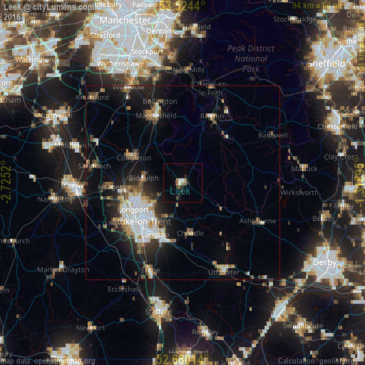

Analysis of Leek night lights 2016
Square area 10x10 km:
 1.06%
1.06%90-99
1.06%80-89
0%70-79
0.53%60-69
1.59%50-59
1.46%40-49
1.19%30-39
0%20-29
2.38%10-19
1.06%0-9
89.68%Square area 50x50 km:
2.01%90-99
1.79%80-89
1.03%70-79
0.88%60-69
1.16%50-59
1.44%40-49
1.45%30-39
1.64%20-29
2.91%10-19
6.73%0-9
78.97%Clear (daylight) street map image can be seen on geolist.org.
Map coordinates:
53° 31' 27.8" North, 2° 43' 30.7" West
53° 6' 15.6" North, 2° 1' 19.5" West
52° 40' 48.5" North, 1° 19' 8.2" West
Some cities around Leek sort by population:
• Stoke-on-Trent
15.6 km =9.7 mi,  224°
224°
• Newcastle under Lyme
18.3 km =11.4 mi,  230°
230°
• Kidsgrove
14.5 km =9 mi,  262°
262°
• Congleton
14.3 km =8.9 mi,  297°
297°
• Biddulph
10.4 km =6.5 mi,  277°
277°
• Longton
15.4 km =9.6 mi,  208°
208°
• Cheadle
13.7 km =8.5 mi,  169°
169°
• Tunstall
13.6 km =8.5 mi,  247°
247°
2644684 (p: 19,903)
Sources (retrieved 2019-11-25):
» Earth at Night: Flat Maps 2012, 2016