Vitry-sur-Seine night lights from space
Night Light of Vitry-sur-Seine (Île-de-France) from space (France) Src. Average luminocity for 10x10km area is 99.4276% and for 50x50km: 75.0914%.
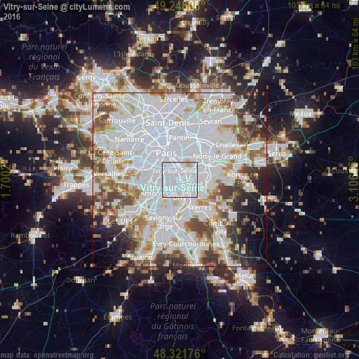

Analysis of Vitry-sur-Seine night lights 2016
Square area 10x10 km:
 85.37%
90-99
12.64%80-89
1.7%70-79
0.28%60-69
0%50-59
0%40-49
0%30-39
0%20-29
0%10-19
0%0-9
0%Square area 50x50 km:
35.98%90-99
19.12%80-89
5.07%70-79
5.34%60-69
5.78%50-59
4.45%40-49
5.34%30-39
4.76%20-29
4.69%10-19
4.79%0-9
4.68%Clear (daylight) street map image can be seen on geolist.org.
Map coordinates:
49° 14' 53.8" North, 1° 42' 0.7" East
48° 47' 13.8" North, 2° 24' 12" East
48° 19' 18.3" North, 3° 6' 23.2" East
Some cities around Vitry-sur-Seine sort by population:
• Ivry-sur-Seine
3.4 km =2.1 mi,  336°
336°
• Maisons-Alfort
3.8 km =2.4 mi,  44°
44°
• Villejuif
3.3 km =2.1 mi,  283°
283°
• Alfortville
2.4 km =1.5 mi,  31°
31°
• Choisy-le-Roi
2.4 km =1.5 mi,  151°
151°
• Charenton-le-Pont
3.9 km =2.4 mi,  9°
9°
• Thiais
2.5 km =1.6 mi,  192°
192°
• Saint-Maurice
4.2 km =2.6 mi,  24°
24°
2967849 (p: 81,001)
Sources (retrieved 2019-11-25):
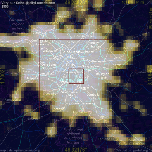
» NASA, Earths city lights 1995
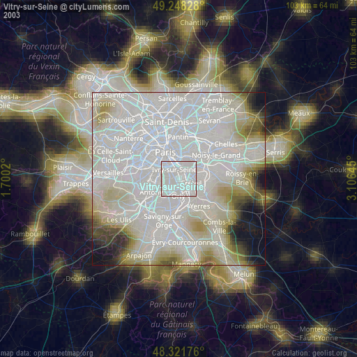
» NASA city lights 2003
» Earth at Night: Flat Maps 2012, 2016