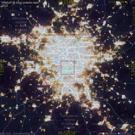
Villejuif night lights from space
Night Light of Villejuif (Île-de-France) from space (France) Src. Average luminocity for 10x10km area is 99.7074% and for 50x50km: 76.4867%.

Analysis of Villejuif night lights 2016
Square area 10x10 km:
 84.94%
90-99
14.49%80-89
0.57%70-79
0%60-69
0%50-59
0%40-49
0%30-39
0%20-29
0%10-19
0%0-9
0%Square area 50x50 km:
36.49%90-99
19.68%80-89
5.46%70-79
5.3%60-69
5.85%50-59
4.56%40-49
5.7%30-39
5.15%20-29
4.07%10-19
3.67%0-9
4.08%Clear (daylight) street map image can be seen on geolist.org.
Map coordinates:
49° 15' 17.9" North, 1° 39' 24.4" East
48° 47' 38" North, 2° 21' 35.7" East
48° 19' 42.8" North, 3° 3' 46.9" East
Some cities around Villejuif sort by population:
• Vitry-sur-Seine
3.3 km =2.1 mi,  103°
103°
• Ivry-sur-Seine
3 km =1.9 mi,  37°
37°
• L'Haÿ-les-Roses
2.3 km =1.4 mi,  238°
238°
• Le Kremlin-Bicêtre
2.3 km =1.4 mi,  1°
1°
• Cachan
1.7 km =1.1 mi,  278°
278°
• Chevilly-Larue
3.3 km =2.1 mi,  192°
192°
• Arcueil
2.1 km =1.3 mi,  288°
288°
• Gentilly
2.5 km =1.6 mi,  327°
327°
2968705 (p: 48,048)
Sources (retrieved 2019-11-25):
» Earth at Night: Flat Maps 2012, 2016