Viriat night lights from space
Night Light of Viriat (Auvergne-Rhône-Alpes) from space (France) Src. Average luminocity for 10x10km area is 23.4301% and for 50x50km: 4.2271%.
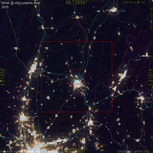
Analysis of Viriat night lights 2016
Square area 10x10 km:
 4.61%
4.61%90-99
4.91%80-89
1.49%70-79
0.3%60-69
1.19%50-59
4.17%40-49
2.23%30-39
2.68%20-29
8.04%10-19
26.34%0-9
44.05%Square area 50x50 km:
0.43%90-99
0.55%80-89
0.23%70-79
0.42%60-69
0.53%50-59
0.88%40-49
0.67%30-39
0.79%20-29
1.2%10-19
2.94%0-9
91.36%Clear (daylight) street map image can be seen on geolist.org.
Map coordinates:
46° 44' 19.9" North, 4° 30' 45.1" East
46° 15' 17.4" North, 5° 12' 56.4" East
45° 45' 59.4" North, 5° 55' 7.6" East
Some cities around Viriat sort by population:
• Bourg-en-Bresse
5.5 km =3.4 mi,  171°
171°
• Mâcon
30.5 km =19 mi,  282°
282°
• Oyonnax
34 km =21.1 mi,  89°
89°
• Ambérieu-en-Bugey
34.5 km =21.4 mi,  162°
162°
• Meximieux
38.6 km =24 mi,  181°
181°
• Charnay-lès-Mâcon
33.6 km =20.9 mi, 280°
• Péronnas
8 km =5 mi, 182°
• Belleville
39.4 km =24.5 mi,  245°
245°
2967949 (p: 5,850)
Sources (retrieved 2019-11-25):
» Earth at Night: Flat Maps 2012, 2016