Belleville night lights from space
Night Light of Belleville (Auvergne-Rhône-Alpes) from space (France) Src. Average luminocity for 10x10km area is 18.554% and for 50x50km: 8.7476%.
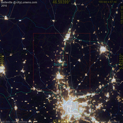
Analysis of Belleville night lights 2016
Square area 10x10 km:
 1.56%
1.56%90-99
1.85%80-89
0.57%70-79
1.14%60-69
3.41%50-59
5.4%40-49
3.55%30-39
2.98%20-29
0.28%10-19
25%0-9
54.26%Square area 50x50 km:
1.06%90-99
1.14%80-89
0.58%70-79
0.88%60-69
0.91%50-59
1.36%40-49
1.8%30-39
1.67%20-29
3.63%10-19
6.73%0-9
80.23%Clear (daylight) street map image can be seen on geolist.org.
Map coordinates:
46° 35' 38.4" North, 4° 2' 45.9" East
46° 6' 31.2" North, 4° 44' 57.1" East
45° 37' 8.5" North, 5° 27' 8.4" East
Some cities around Belleville sort by population:
• Mâcon
23.6 km =14.7 mi,  14°
14°
• Villefranche-sur-Saône
13.4 km =8.3 mi,  189°
189°
• Gleizé
13.9 km =8.6 mi,  196°
196°
• Neuville-sur-Saône
26.8 km =16.7 mi,  164°
164°
• Charnay-lès-Mâcon
22.3 km =13.9 mi, 7°
• Trévoux
18.5 km =11.5 mi,  174°
174°
• Jassans-Riottier
14.2 km =8.8 mi,  176°
176°
• Anse
19.4 km =12.1 mi, 186°
3033636 (p: 6,299)
Sources (retrieved 2019-11-25):
» Earth at Night: Flat Maps 2012, 2016