Ambérieu-en-Bugey night lights from space
Night Light of Ambérieu-en-Bugey (Auvergne-Rhône-Alpes) from space (France) Src. Average luminocity for 10x10km area is 23.6577% and for 50x50km: 9.4791%.
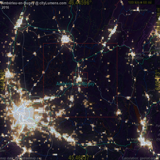
Analysis of Ambérieu-en-Bugey night lights 2016
Square area 10x10 km:
 2.68%
2.68%90-99
3.87%80-89
3.87%70-79
2.38%60-69
2.83%50-59
1.49%40-49
1.79%30-39
3.13%20-29
2.23%10-19
41.22%0-9
34.52%Square area 50x50 km:
0.82%90-99
1.18%80-89
0.73%70-79
1.22%60-69
1.07%50-59
1.41%40-49
1.33%30-39
2.11%20-29
3.33%10-19
8.73%0-9
78.08%Clear (daylight) street map image can be seen on geolist.org.
Map coordinates:
46° 26' 45.5" North, 4° 38' 54.5" East
45° 57' 33.6" North, 5° 21' 5.8" East
45° 28' 6.1" North, 6° 3' 17" East
Some cities around Ambérieu-en-Bugey sort by population:
• Bourg-en-Bresse
29.1 km =18.1 mi,  340°
340°
• Charvieu-Chavagneux
28 km =17.4 mi,  213°
213°
• Meximieux
13.1 km =8.1 mi,  244°
244°
• Montluel
25.7 km =16 mi, 242°
• Lagnieu
6.4 km =4 mi,  185°
185°
• Péronnas
27.2 km =16.9 mi, 336°
• Jonage
29.8 km =18.5 mi,  232°
232°
• Tignieu
26.3 km =16.3 mi, 208°
3037943 (p: 13,260)
Sources (retrieved 2019-11-25):
» Earth at Night: Flat Maps 2012, 2016