Villeneuve-d'Ascq night lights from space
Night Light of Villeneuve-d'Ascq (Hauts-de-France) from space (France) Src. Average luminocity for 10x10km area is 77.4465% and for 50x50km: 48.4432%.
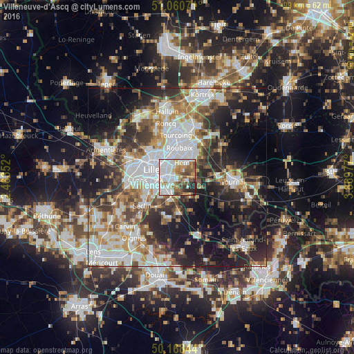
Analysis of Villeneuve-d'Ascq night lights 2016
Square area 10x10 km:
 30.75%
90-99
19.79%80-89
5.08%70-79
9.22%60-69
8.42%50-59
8.69%40-49
7.35%30-39
4.14%20-29
5.75%10-19
0.8%0-9
0%Square area 50x50 km:
12.3%90-99
10.13%80-89
4.17%70-79
5.48%60-69
6.42%50-59
6.29%40-49
6.45%30-39
6.8%20-29
12.18%10-19
17.24%0-9
12.54%Clear (daylight) street map image can be seen on geolist.org.
Map coordinates:
51° 3' 38.6" North, 2° 27' 48.7" East
50° 37' 0.1" North, 3° 9' 59.9" East
50° 10' 6.4" North, 3° 52' 11.2" East
Some cities around Villeneuve-d'Ascq sort by population:
• La Madeleine
7.2 km =4.5 mi,  296°
296°
• Mons-en-Barœul
4 km =2.5 mi, 297°
• Croix
7 km =4.3 mi,  349°
349°
• Hem
4.2 km =2.6 mi,  19°
19°
• Wasquehal
6.4 km =4 mi,  338°
338°
• Ronchin
5.7 km =3.5 mi,  249°
249°
• Lys-lez-Lannoy
6.6 km =4.1 mi,  32°
32°
• Lesquin
5.1 km =3.2 mi,  221°
221°
6543862 (p: 62,400)
Sources (retrieved 2019-11-25):
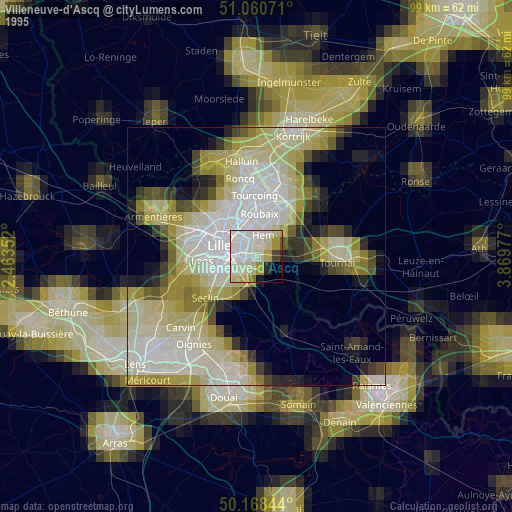
» NASA, Earths city lights 1995
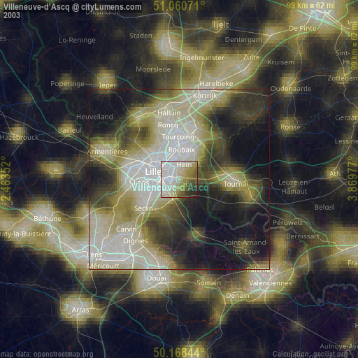
» NASA city lights 2003
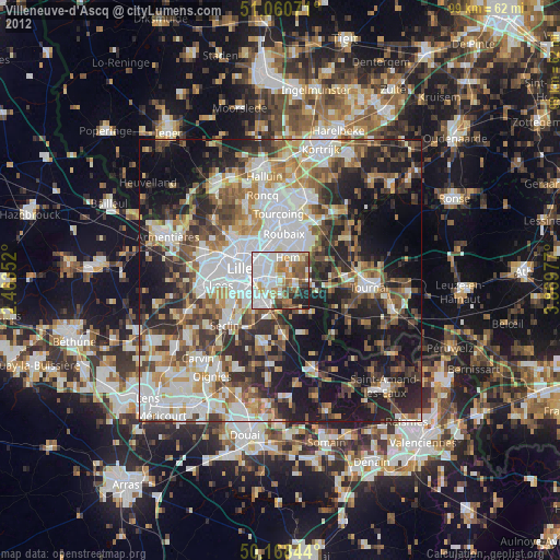
» Earth at Night: Flat Maps 2012, 2016