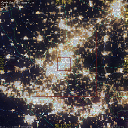
Croix night lights from space
Night Light of Croix (Hauts-de-France) from space (France) Src. Average luminocity for 10x10km area is 94.2513% and for 50x50km: 46.7355%.
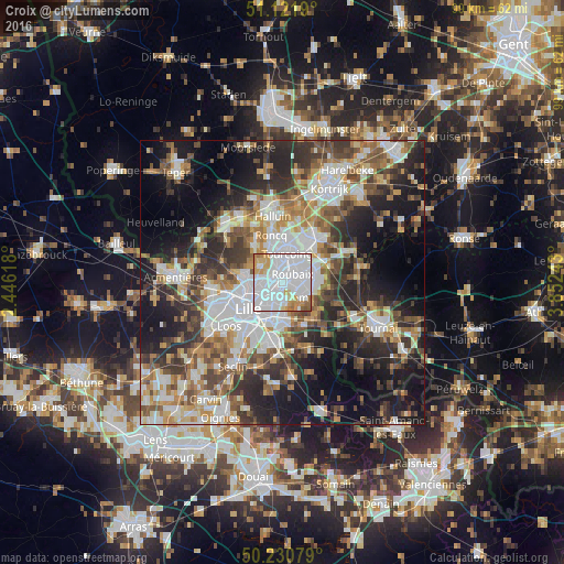
Analysis of Croix night lights 2016
Square area 10x10 km:
 66.18%
90-99
14.17%80-89
5.35%70-79
7.62%60-69
4.14%50-59
2.14%40-49
0.4%30-39
0%20-29
0%10-19
0%0-9
0%Square area 50x50 km:
11.08%90-99
8.83%80-89
4.18%70-79
5.64%60-69
6.52%50-59
6.82%40-49
6.86%30-39
7.52%20-29
11.75%10-19
16.7%0-9
14.11%Clear (daylight) street map image can be seen on geolist.org.
Map coordinates:
51° 7' 18.8" North, 2° 26' 46.2" East
50° 40' 42.5" North, 3° 8' 57.5" East
50° 13' 50.8" North, 3° 51' 8.7" East
Some cities around Croix sort by population:
• Roubaix
2.5 km =1.6 mi,  45°
45°
• Tourcoing
5.1 km =3.2 mi,  9°
9°
• Marcq-en-Barœul
4.8 km =3 mi,  254°
254°
• Hem
3.9 km =2.4 mi,  137°
137°
• Wasquehal
1.4 km =0.9 mi,  230°
230°
• Lys-lez-Lannoy
4.9 km =3 mi,  105°
105°
• Mouvaux
2.6 km =1.6 mi,  335°
335°
• Bondues
4.6 km =2.9 mi,  304°
304°
3022376 (p: 21,361)
Sources (retrieved 2019-11-25):
» Earth at Night: Flat Maps 2012, 2016