Lys-lez-Lannoy night lights from space
Night Light of Lys-lez-Lannoy (Hauts-de-France) from space (France) Src. Average luminocity for 10x10km area is 75.0254% and for 50x50km: 45.2624%.
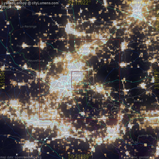
Analysis of Lys-lez-Lannoy night lights 2016
Square area 10x10 km:
 37.97%
90-99
10.96%80-89
3.88%70-79
8.02%60-69
6.55%50-59
8.29%40-49
10.16%30-39
5.88%20-29
7.75%10-19
0.53%0-9
0%Square area 50x50 km:
10.88%90-99
8.42%80-89
4.04%70-79
5.39%60-69
6.2%50-59
6.42%40-49
6.66%30-39
7.13%20-29
11.39%10-19
17.22%0-9
16.26%Clear (daylight) street map image can be seen on geolist.org.
Map coordinates:
51° 6' 36.8" North, 2° 30' 48.7" East
50° 40' 0" North, 3° 13' 0" East
50° 13' 8" North, 3° 55' 11.2" East
Some cities around Lys-lez-Lannoy sort by population:
• Roubaix
4.3 km =2.7 mi,  315°
315°
• Villeneuve-d'Ascq
6.6 km =4.1 mi,  212°
212°
• Wattrelos
3.8 km =2.4 mi,  1°
1°
• Croix
4.9 km =3 mi,  285°
285°
• Hem
2.6 km =1.6 mi,  233°
233°
• Wasquehal
5.9 km =3.7 mi,  274°
274°
• Leers
2.6 km =1.6 mi,  48°
48°
• Estaimpuis, BE
5.6 km =3.5 mi,  40°
40°
2996927 (p: 13,803)
Sources (retrieved 2019-11-25):
» Earth at Night: Flat Maps 2012, 2016