Hem night lights from space
Night Light of Hem (Hauts-de-France) from space (France) Src. Average luminocity for 10x10km area is 84.1671% and for 50x50km: 46.7007%.
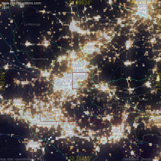
Analysis of Hem night lights 2016
Square area 10x10 km:
 47.06%
90-99
15.37%80-89
4.28%70-79
7.89%60-69
5.88%50-59
8.56%40-49
6.95%30-39
2.01%20-29
2.01%10-19
0%0-9
0%Square area 50x50 km:
11.38%90-99
8.99%80-89
4.18%70-79
5.63%60-69
6.48%50-59
6.44%40-49
6.56%30-39
6.96%20-29
11.79%10-19
17.05%0-9
14.55%Clear (daylight) street map image can be seen on geolist.org.
Map coordinates:
51° 5' 46.5" North, 2° 29' 1.3" East
50° 39' 9.2" North, 3° 11' 12.5" East
50° 12' 16.7" North, 3° 53' 23.8" East
Some cities around Hem sort by population:
• Roubaix
4.7 km =2.9 mi,  349°
349°
• Villeneuve-d'Ascq
4.2 km =2.6 mi,  199°
199°
• Wattrelos
5.8 km =3.6 mi,  22°
22°
• Mons-en-Barœul
5.4 km =3.4 mi,  246°
246°
• Croix
3.9 km =2.4 mi,  317°
317°
• Wasquehal
4.2 km =2.6 mi,  298°
298°
• Lys-lez-Lannoy
2.6 km =1.6 mi,  53°
53°
• Leers
5.2 km =3.2 mi, 50°
3013549 (p: 19,699)
Sources (retrieved 2019-11-25):
» Earth at Night: Flat Maps 2012, 2016