Mons-en-Barœul night lights from space
Night Light of Mons-en-Barœul (Hauts-de-France) from space (France) Src. Average luminocity for 10x10km area is 94.1564% and for 50x50km: 49.1084%.
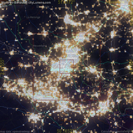
Analysis of Mons-en-Barœul night lights 2016
Square area 10x10 km:
 62.57%
90-99
20.86%80-89
3.61%70-79
4.55%60-69
4.01%50-59
2.67%40-49
1.07%30-39
0.67%20-29
0%10-19
0%0-9
0%Square area 50x50 km:
12.51%90-99
10.16%80-89
4.22%70-79
5.71%60-69
6.68%50-59
6.55%40-49
6.81%30-39
6.95%20-29
11.25%10-19
16.75%0-9
12.42%Clear (daylight) street map image can be seen on geolist.org.
Map coordinates:
51° 4' 37.9" North, 2° 24' 48.8" East
50° 37' 60" North, 3° 7' 0" East
50° 11' 6.8" North, 3° 49' 11.3" East
Some cities around Mons-en-Barœul sort by population:
• Lille
4.1 km =2.5 mi,  269°
269°
• Villeneuve-d'Ascq
4 km =2.5 mi,  117°
117°
• Marcq-en-Barœul
4.4 km =2.7 mi,  327°
327°
• La Madeleine
3.2 km =2 mi,  296°
296°
• Croix
5.5 km =3.4 mi,  24°
24°
• Hem
5.4 km =3.4 mi,  66°
66°
• Wasquehal
4.3 km =2.7 mi, 16°
• Ronchin
4.3 km =2.7 mi,  205°
205°
2993207 (p: 23,006)
Sources (retrieved 2019-11-25):
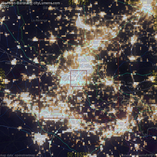
» Earth at Night: Flat Maps 2012, 2016