Cachan night lights from space
Night Light of Cachan (Île-de-France) from space (France) Src. Average luminocity for 10x10km area is 99.7486% and for 50x50km: 76.8496%.
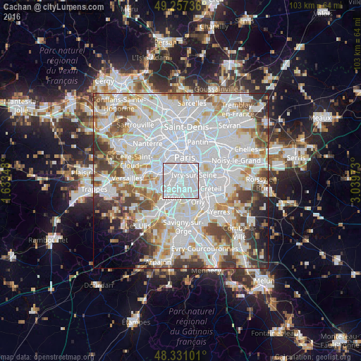
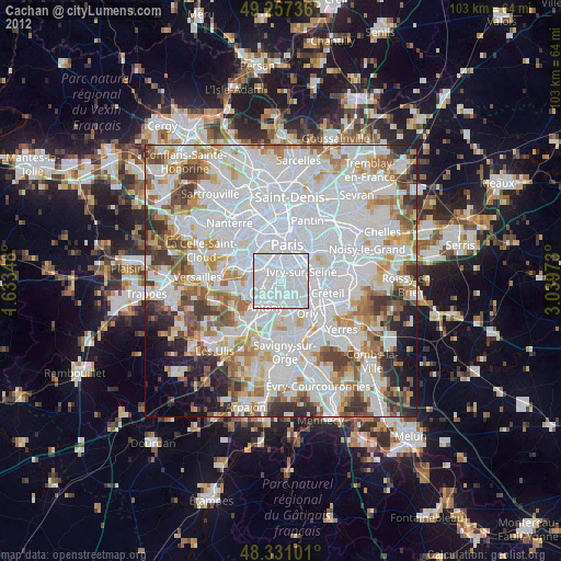
Analysis of Cachan night lights 2016
Square area 10x10 km:
 85.8%
85.8%90-99
13.64%80-89
0.57%70-79
0%60-69
0%50-59
0%40-49
0%30-39
0%20-29
0%10-19
0%0-9
0%Square area 50x50 km:
36.59%90-99
19.79%80-89
5.6%70-79
5.41%60-69
5.89%50-59
4.7%40-49
6.01%30-39
4.88%20-29
3.8%10-19
2.9%0-9
4.43%Clear (daylight) street map image can be seen on geolist.org.
Map coordinates:
49° 15' 26.5" North, 1° 38' 0.5" East
48° 47' 46.8" North, 2° 20' 11.8" East
48° 19' 51.6" North, 3° 2' 23" East
Some cities around Cachan sort by population:
• Villejuif
1.7 km =1.1 mi,  98°
98°
• Bagneux
2.1 km =1.3 mi,  267°
267°
• Montrouge
2.8 km =1.7 mi,  323°
323°
• L'Haÿ-les-Roses
1.5 km =0.9 mi,  189°
189°
• Le Kremlin-Bicêtre
2.7 km =1.7 mi,  40°
40°
• Bourg-la-Reine
2.4 km =1.5 mi,  215°
215°
• Arcueil
0.5 km =0.3 mi, 323°
• Gentilly
1.9 km =1.2 mi,  11°
11°
3029276 (p: 26,540)
Sources (retrieved 2019-11-25):
» Earth at Night: Flat Maps 2012, 2016