Gentilly night lights from space
Night Light of Gentilly (Île-de-France) from space (France) Src. Average luminocity for 10x10km area is 99.8636% and for 50x50km: 77.6747%.
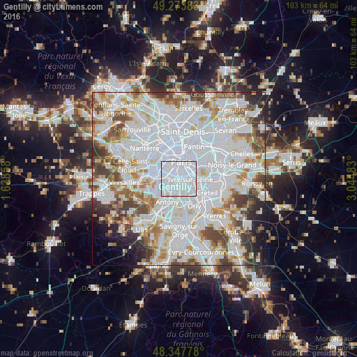
Analysis of Gentilly night lights 2016
Square area 10x10 km:
 91.48%
90-99
8.24%80-89
0.28%70-79
0%60-69
0%50-59
0%40-49
0%30-39
0%20-29
0%10-19
0%0-9
0%Square area 50x50 km:
36.74%90-99
20.09%80-89
5.8%70-79
5.45%60-69
6.01%50-59
5.02%40-49
6.17%30-39
4.52%20-29
3.81%10-19
2.92%0-9
3.47%Clear (daylight) street map image can be seen on geolist.org.
Map coordinates:
49° 16' 25.8" North, 1° 38' 18.9" East
48° 48' 46.6" North, 2° 20' 30.1" East
48° 20' 52" North, 3° 2' 41.4" East
Some cities around Gentilly sort by population:
• Ivry-sur-Seine
3.2 km =2 mi,  84°
84°
• Villejuif
2.5 km =1.6 mi,  147°
147°
• Bagneux
3.1 km =1.9 mi,  232°
232°
• Montrouge
2.1 km =1.3 mi,  280°
280°
• Malakoff
3.2 km =2 mi, 284°
• Le Kremlin-Bicêtre
1.4 km =0.9 mi, 81°
• Cachan
1.9 km =1.2 mi,  191°
191°
• Arcueil
1.6 km =1 mi,  204°
204°
3016292 (p: 15,939)
Sources (retrieved 2019-11-25):
» Earth at Night: Flat Maps 2012, 2016