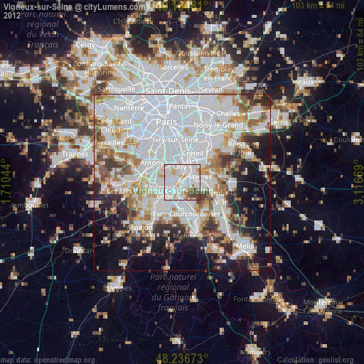
Vigneux-sur-Seine night lights from space
Night Light of Vigneux-sur-Seine (Île-de-France) from space (France) Src. Average luminocity for 10x10km area is 91.2887% and for 50x50km: 63.3971%.
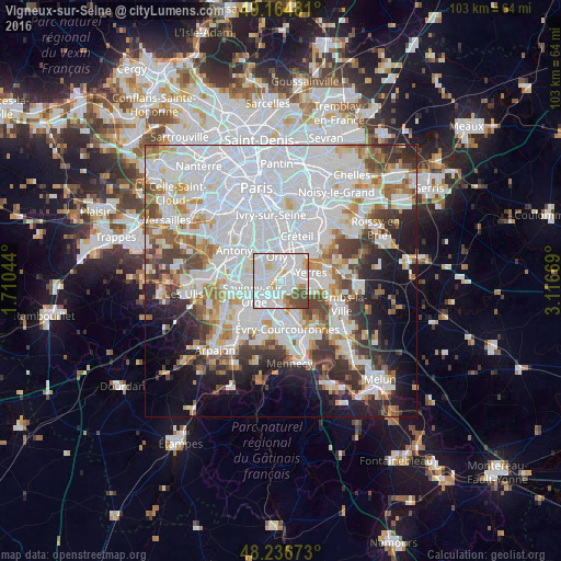
Analysis of Vigneux-sur-Seine night lights 2016
Square area 10x10 km:
 48.36%
90-99
28.57%80-89
7.59%70-79
2.98%60-69
1.93%50-59
4.02%40-49
6.55%30-39
0%20-29
0%10-19
0%0-9
0%Square area 50x50 km:
28.91%90-99
14.95%80-89
4.15%70-79
4.67%60-69
5.39%50-59
4.24%40-49
4.87%30-39
5.07%20-29
6.51%10-19
8.24%0-9
13%Clear (daylight) street map image can be seen on geolist.org.
Map coordinates:
49° 9' 53.3" North, 1° 42' 37.6" East
48° 42' 10.5" North, 2° 24' 48.9" East
48° 14' 12.2" North, 3° 7' 0.1" East
Some cities around Vigneux-sur-Seine sort by population:
• Athis-Mons
1.6 km =1 mi,  278°
278°
• Viry-Châtillon
3.7 km =2.3 mi,  203°
203°
• Draveil
2 km =1.2 mi,  178°
178°
• Montgeron
2.7 km =1.7 mi,  84°
84°
• Juvisy-sur-Orge
3.1 km =1.9 mi,  225°
225°
• Crosne
3.7 km =2.3 mi,  60°
60°
• Paray-Vieille-Poste
3.9 km =2.4 mi,  288°
288°
• Ablon-sur-Seine
2.9 km =1.8 mi,  19°
19°
2969109 (p: 26,692)
Sources (retrieved 2019-11-25):
» Earth at Night: Flat Maps 2012, 2016