Crosne night lights from space
Night Light of Crosne (Île-de-France) from space (France) Src. Average luminocity for 10x10km area is 90.4524% and for 50x50km: 64.3231%.
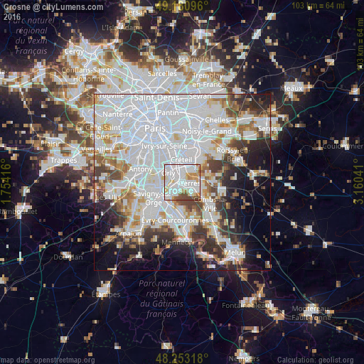
Analysis of Crosne night lights 2016
Square area 10x10 km:
 45.24%
90-99
27.83%80-89
6.25%70-79
8.48%60-69
3.57%50-59
3.13%40-49
5.51%30-39
0%20-29
0%10-19
0%0-9
0%Square area 50x50 km:
30.24%90-99
15.19%80-89
4.08%70-79
4.53%60-69
4.91%50-59
3.89%40-49
4.63%30-39
5.13%20-29
6.79%10-19
8.4%0-9
12.21%Clear (daylight) street map image can be seen on geolist.org.
Map coordinates:
49° 10' 51.5" North, 1° 45' 15" East
48° 43' 9.2" North, 2° 27' 26.2" East
48° 15' 11.4" North, 3° 9' 37.5" East
Some cities around Crosne sort by population:
• Villeneuve-Saint-Georges
1.6 km =1 mi,  337°
337°
• Yerres
2.7 km =1.7 mi,  93°
93°
• Vigneux-sur-Seine
3.7 km =2.3 mi,  240°
240°
• Brunoy
3.8 km =2.4 mi,  137°
137°
• Montgeron
1.6 km =1 mi,  198°
198°
• Limeil-Brévannes
3.6 km =2.2 mi,  37°
37°
• Valenton
2.9 km =1.8 mi,  10°
10°
• Ablon-sur-Seine
2.4 km =1.5 mi,  292°
292°
3022301 (p: 8,592)
Sources (retrieved 2019-11-25):
» Earth at Night: Flat Maps 2012, 2016