Igny night lights from space
Night Light of Igny (Île-de-France) from space (France) Src. Average luminocity for 10x10km area is 82.4301% and for 50x50km: 64.3286%.
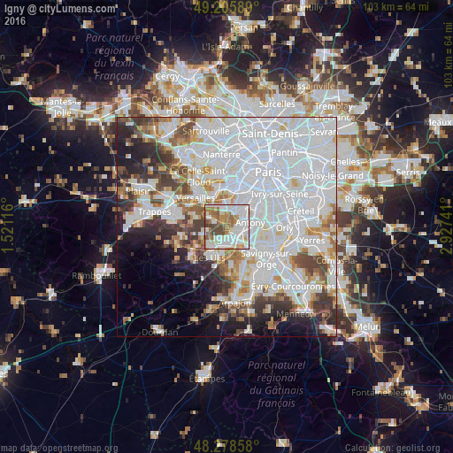
Analysis of Igny night lights 2016
Square area 10x10 km:
 26.19%
90-99
30.51%80-89
4.61%70-79
7.14%60-69
13.24%50-59
8.78%40-49
8.93%30-39
0.6%20-29
0%10-19
0%0-9
0%Square area 50x50 km:
31.02%90-99
15.05%80-89
4.32%70-79
4.17%60-69
4.9%50-59
3.95%40-49
5.19%30-39
4.44%20-29
5.83%10-19
6.35%0-9
14.78%Clear (daylight) street map image can be seen on geolist.org.
Map coordinates:
49° 12' 21.2" North, 1° 31' 16.2" East
48° 44' 39.7" North, 2° 13' 27.4" East
48° 16' 42.9" North, 2° 55' 38.7" East
Some cities around Igny sort by population:
• Antony
5.4 km =3.4 mi,  79°
79°
• Massy
4.7 km =2.9 mi,  114°
114°
• Châtenay-Malabry
3.9 km =2.4 mi,  53°
53°
• Palaiseau
3.5 km =2.2 mi,  147°
147°
• Vélizy-Villacoublay
4.7 km =2.9 mi,  332°
332°
• Verrières-le-Buisson
3.2 km =2 mi,  87°
87°
• Villebon-sur-Yvette
4.4 km =2.7 mi,  164°
164°
• Jouy-en-Josas
4.3 km =2.7 mi,  292°
292°
3012889 (p: 9,968)
Sources (retrieved 2019-11-25):
» Earth at Night: Flat Maps 2012, 2016